

After a way warmer and drier than normal July, with temperature trending nearly 3 degrees above average and only 25% of Kelowna’s normal precipitation recorded throughout the month, August kicks off with some changes.


An upper trough is drawing in cooler and more unsettled conditions heading into the long weekend.
Environment Canada issued a severe thunderstorm watch for the Shuswap and West Columbia region on Thursday advising of the potential for strong storms during the afternoon.
The special air quality statement that has been out for over 2 weeks straight continues in the Okanagan, reminding people of the potential for smoke to increase and decrease at times and to seek indoor spaces if experiencing difficulty breathing.
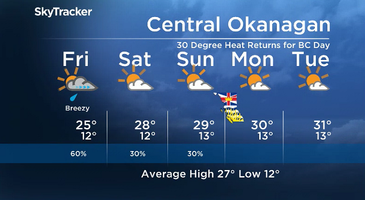
After the risk of rain and risk of storms subsides on Thursday, Pacific moisture will push in a more organized wave of precipitation Friday.

Get daily National news
A few rounds of rain are expected to swing through during the first half of the day with a chance of thunderstorms in the afternoon and early evening.
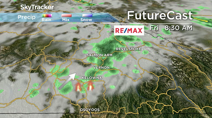
The good news with these storms is that they’ll come with cooler temperatures and a bit more rain, with an afternoon high only expected to top out in the mid-20s to round off the week.
Daytime highs do gradually recover through August long weekend with daytime highs climbing up into the upper 20s Saturday and Sunday before reaching back into the 30s for BC Day on Monday.
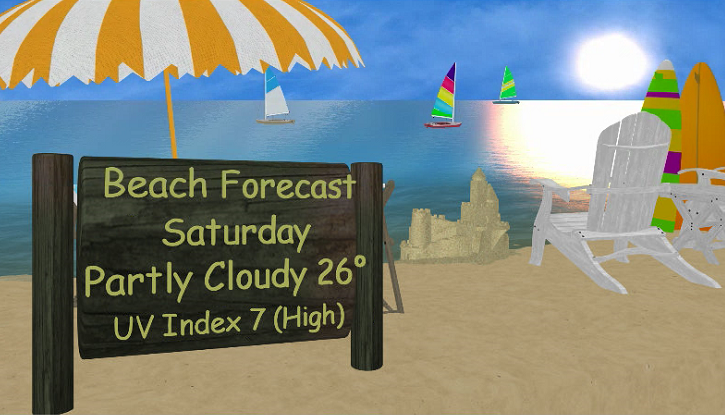
A mix of sun and cloud will dominate the first half of the long weekend with a slight chance of late day showers Saturday and Sunday before mostly sunny skies move in on Monday.
There is an upper low off the coast that will push the heat back in early next week with a return to dry conditions and daytime highs bouncing back into the mid-30s.
For weather on the go download the Global News SkyTracker Weather App for iPhone, iPad or Android.


Comments
Want to discuss? Please read our Commenting Policy first.