Blast of snow brings back winter, but a big warm up is on the way.

Special Weather Statement Ended
Environment Canada has ended a special weather statement for Saskatoon, Prince Albert and other parts of Saskatchewan for up to 10 centimetres of snow from a slow moving low pressure trough.
Within the relatively narrow band is where the heaviest snow moved through with amounts of five to 10 cm.
The zone of heavier snow was from Rockglen and Assiniboia in the south, through Moose Jaw, Elbow, Saskatoon, Prince Albert, Spiritwood, and Meadow Lake.
Travelers were asked to keep in mind that visibilities and road conditions could change suddenly from one area to the next.
For the latest weather alerts download the Global News SkyTracker Weather App for iPhone, iPad or Android.

Get breaking National news
Saskatoon Forecast
Tuesday
Winter rolled back in Tuesday morning with snow falling heavily at times as winds gusted upwards of 50 km/h reducing visibility to a few hundred metres.
Temperatures stayed around the freezing mark through the morning with wind chills close to minus double digits as slick and treacherous travel conditions continued right into the middle of the day.
Snow continued with breezy southeasterly winds gusting up to 50 km/h at times for the remainder of the day with five to nine centimetres in the city by evening as temperatures sat around the freezing mark.
Wednesday
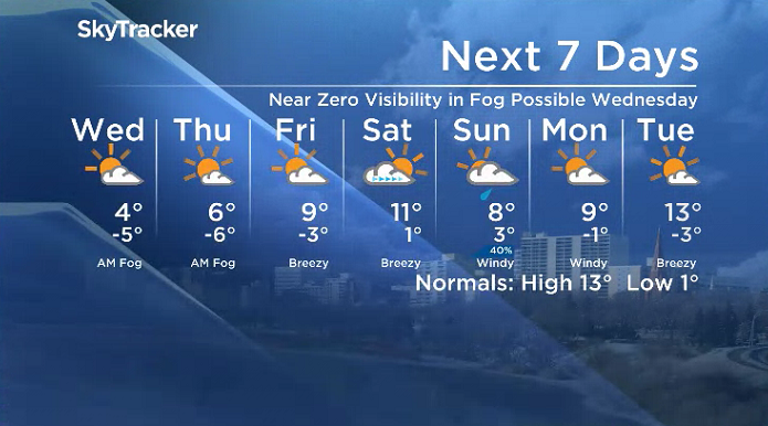
It’ll feel like the minus teens with wind chill as you head out the door Wednesday morning with fog patches potentially reducing visibility at times in some areas.
A mix of sun and cloud will start off the day before skies clear out even more to wrap up the day as we get up to an afternoon high in mid-positive single digits with lots of melting snow.

Thursday-Friday
A mix of sun and cloud will stick around for the rest of the week as an upper ridge build back in the heat with some breezy southerly winds kicking in on Friday.
Daytime highs will soar from mid-single digits on Thursday, possibly up as warm as double digits as early as Friday.
Weekend Outlook
Double digits heat is sure to be reached by Saturday ahead of a system sliding in that’ll bring back the clouds and add in a chance of showers on Sunday as we cool back a few degrees to wrap up the weekend with some very strong southerly wind gusts possible.


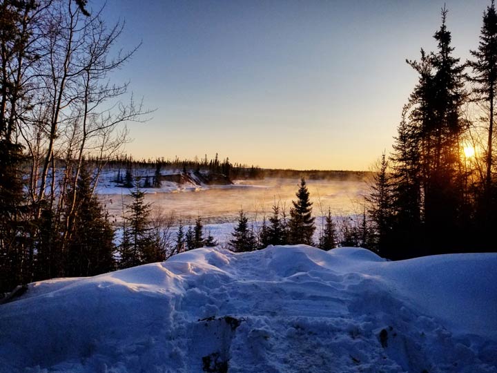
Gregory Lowey took the April 17 Your Saskatchewan photo in Stony Rapids:
Saskatoon weather outlook is your source for Saskatoon’s most accurate forecast and is your one stop shop for all things weather for central and northern Saskatchewan with comprehensive, in depth analysis that you can only find here.


Comments