

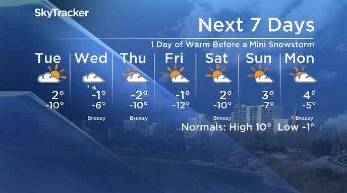
A one-day warm-up is on the way before another blast of snow.

Saskatoon Forecast
Monday
After a record-breaking weekend with a low of -22.9 degrees on Saturday, shattering our previous record of -20 degrees from 1954 as wind chills dove back into the -30s.
It was a snowy start to the week Monday morning with six hours of light snow to start the day as temperatures slid back to -9 with wind chills in the minus teens before the mercury rose into mid-minus single digits before noon.
Clouds stuck around for the rest of the day as we climbed up to an afternoon high just shy of the freezing mark.
Tuesday
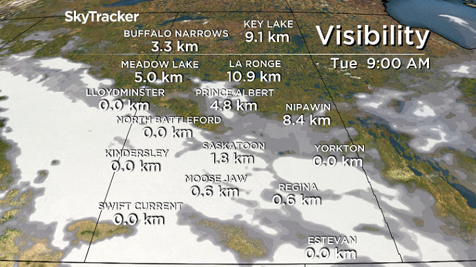
-15 is around what it’ll feel like Tuesday morning with wind chill as you’re heading out in the morning with some sunny breaks possible to start the day along with fog that could reduce visibility at times before clouds roll back in midday.
We’ll finally make it above the freezing mark by the afternoon as warm air presses in ahead of a snowstorm that’s slated to slide in late Tuesday night into early Wednesday morning.
Wednesday-Friday
Snow moves in on Wednesday as a low pressure system slides into the province with five to 10 centimetres possible in central Saskatchewan with lingering cloud Thursday before we could catch some sunshine on Friday.
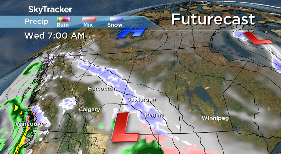
Winds will be a bit breezy as the snow falls Wednesday with daytime highs staying just shy of the freezing mark for the rest of the week.


Weekend Outlook
Warmer air finally moves in mid-month with clouds in and out over the weekend as daytime highs spring back up a few degrees above freezing.
Elaine McMillan took the April 9 Your Saskatchewan photo at Christopher Lake:

Saskatoon weather outlook is your source for Saskatoon’s most accurate forecast and is your one stop shop for all things weather for central and northern Saskatchewan with comprehensive, in-depth analysis that you can only find here.
Comments