
UPDATE: All advisories mentioned in this story have ended

More snow is on the way to parts of Saskatchewan that have already seen up to 30 centemetres fall since Sunday.
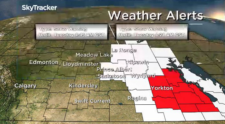
Between 10 and 30 centimetres of snow fell on Sunday and overnight into Monday morning.
Environment Canada says a Colorado low will spread one more wave of heavy snow over portions of most of eastern Saskatchewan on Monday, bringing an additional five to 15 centimetres of snow.
The snow is expected to gradually taper off Monday afternoon and into Tuesday.
Drivers are being advised that road conditions can change quickly.

Get breaking National news
The Highway Hotline says travel is not recommended on many highways, and some highways east and north of Regina were closed early Monday morning.
For the latest weather conditions and alerts, download the Global News SkyTracker weather app for iPhone, iPad or Android.
Snowfall warning ended for:
- Saskatoon
- Regina
- Carlyle – Oxbow – Carnduff – Bienfait – Stoughton
- Estevan – Weyburn – Radville – Milestone
- Fort Qu’Appelle – Indian Head – Lumsden – Pilot Butte
- Hudson Bay – Porcupine Plain
- Humboldt – Wynyard – Wadena – Lanigan – Foam Lake
- La Ronge – Prince Albert Nat. Park – Narrow Hills Prov. Park
- Martensville – Warman – Rosthern – Delisle – Wakaw
- Melfort – Tisdale – Nipawin – Carrot River
- Pelican Narrows – Cumberland House – Creighton
- Prince Albert – Shellbrook – Spiritwood – Duck Lake
- Southend – Brabant Lake – Kinoosao
Winter storm warning ended for:
- Kamsack – Canora – Preeceville
- Moosomin – Grenfell – Kipling – Wawota
- Yorkton – Melville – Esterhazy


Comments
Want to discuss? Please read our Commenting Policy first.