

Arctic air continues to funnel in with extreme cold possible ahead.

Saskatoon Forecast
Monday
After a cold weekend with wind chills down to -41, we had a relatively warmer start to the week with temperatures only dipping back to -24 in the morning, which felt like the mid -30s.
Clouds stuck around to start the day with a few mid-morning sunny breaks before skies filled back in to be overcast by the noon hour as we warmed into the minus teens.
By afternoon the mercury made it into the minus teens with wind chills climbing into the -20s under mostly cloudy skies with winds a bit breezy at times.
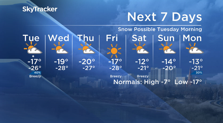
Tuesday
-33 is around what it’ll feel like Tuesday morning with wind chill with clouds and a decent chance of light snow to start the day.
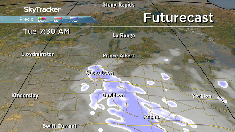
That risk will ease in the afternoon with clouds eventually clearing out as the next arctic high drops in and brings us back into some sun as we rise up into the mid-minus teens with wind chills in the mid -20s.
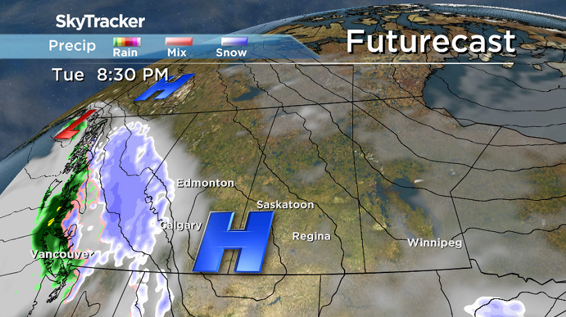
Wednesday-Friday
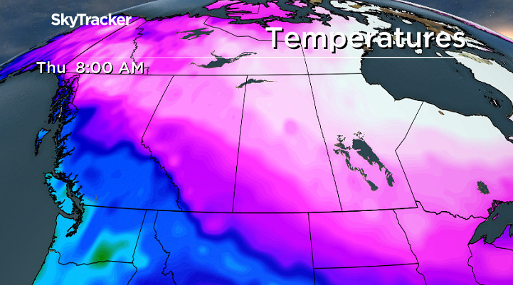
A mix of sun and cloud are on the way Wednesday and Thursday with even more sunshine expected on Friday as we remain on the track of the arctic highs that’ll continue to slide by.
That will keep us cool with daytime highs attempting to make it into the minus teens each day after starting out around -27 or -28 with morning wind chills approaching extreme cold warning criteria of -40 at times.


Weekend Outlook
Warmer air is expected to spill in this weekend with daytime highs pushing up into the minus teens and possibly even a bit warmer as a few more clouds move in.
The Feb. 5 Your Saskatchewan photo was taken by Justin Peevers at Buffalo Pound:

Saskatoon weather outlook is your source for Saskatoon’s most accurate forecast and is your one stop shop for all things weather for central and northern Saskatchewan with comprehensive, in depth analysis that you can only find here.
Comments