
Thursday, January 04, 2018
Weather forecast update at 4:35pm:
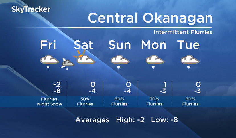
A more dynamic and active weather pattern is expected through the weekend and into next week as multiple waves of moisture will cross our inland regions.

Precipitation type will be mostly flurries or snow in the valleys. However because we have cold air at the surface with warm air riding over the region, areas to the west of the Okanagan including the mountain passes will see a risk of freezing rain.
Signs are pointing to a moderate accumulation of snow Friday evening.
Friday’s daytime high range: -8 to -2C
We will have the rest of your weather details coming up at 5, 6:30 and 11pm – hope you can join us!
~ Duane/Wesla
Comments
Want to discuss? Please read our Commenting Policy first.