

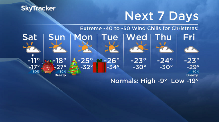
Extreme -40 to -50 wind chills and the polar vortex move in for Christmas.

Saskatoon Forecast
Friday
Slippery roads started the first full day of winter with light snow falling overnight and into the morning, making conditions extra slick.
Saskatoon Police responded to a total of 15 collisions between 5 p.m. and 8 p.m. CT on Thursday evening and advise people to slow down in these conditions.
We started the day around -8 with wind chills making it feel like the minus teens as winds gusted upwards of 35 to 40 km/h as we cooled back into minus double digits later in the morning.
Partly to mostly cloudy skies with a chance of flurries finish off the day with afternoon temperatures up into minus single digits at times.
Friday Night
Mostly cloudy skies with light snow at times dominate the evening and overnight period as conditions cool back into the minus teens overnight.
Saturday

Get daily National news
An arctic cold front sweeping through on Saturday kicks up a chance of snow under cloudy skies to start the weekend.

Daytime temperatures are expected to sit in the minus teens for the majority of the day with wind chills around -20.
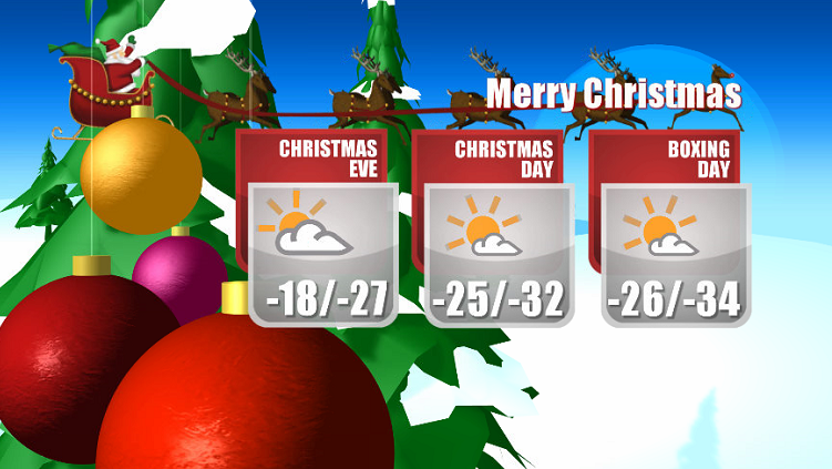
Christmas Eve Sunday
The chance of snow diminishes through Christmas Eve on Sunday as clouds eventually clear out of the region with cool northerly winds ushering in the arctic air.
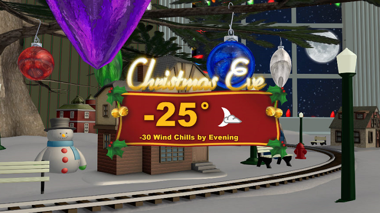
At the same time the polar vortex, the cold pool of arctic air that normally sits over the North Pole, edges in and helps push afternoon temperatures into the -20s and wind chills into the -30s, just as Santa Claus makes his way to our area.

Christmas Day Monday
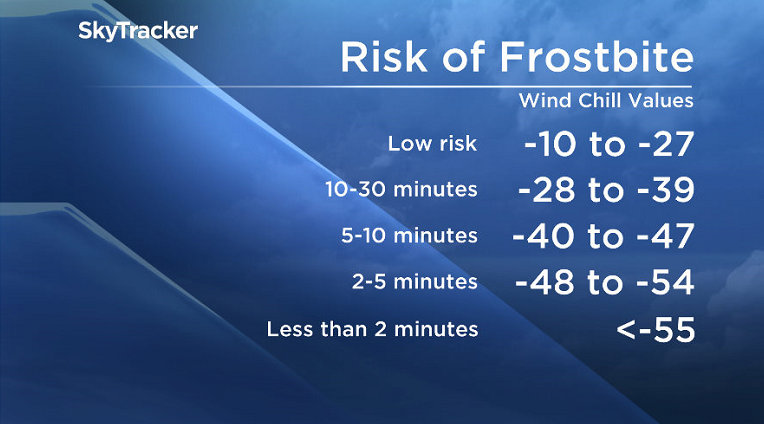
-40 to -50 is what it will feel like on your skin Christmas morning with wind chill as temperatures plummet into the -30s in the morning.


The big day will be filled with lots of sunshine and by afternoon temperatures should be able to make it up into the mid -20s, but wind chills will remain in the -30s all day, meaning exposed skin can freeze in minutes, so be sure to bundle up if heading out!

Boxing Day Tuesday
Boxing Day is shaping up to be just as cold as Christmas, if not even cooler, but at least we’ll be under mostly sunny skies!
The mercury will fall back into the mid -30s to start the day with wind chills back into extreme cold warning criteria, into the -40s before temperatures warm into the -20s and wind chills into the -30s by afternoon.
Week After Christmas Outlook
Arctic air is expected to linger for the rest of the week after Christmas with more clouds moving in along with a chance of flurries, which will help warm daytime highs further into the -20s with morning lows around the -30 degree mark and extreme wind chills touching toward the -40s possible at times.
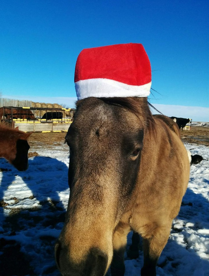
Trent Gerling took the Your Saskatchewan photo for Dec. 22 near Salvador:
Saskatoon weather outlook is your source for Saskatoon’s most accurate forecast and is your one stop shop for all things weather for central and northern Saskatchewan with comprehensive, in depth analysis that you can only find here.
Comments
Want to discuss? Please read our Commenting Policy first.