

Enjoy the mild conditions in the first days of December because it will not last.

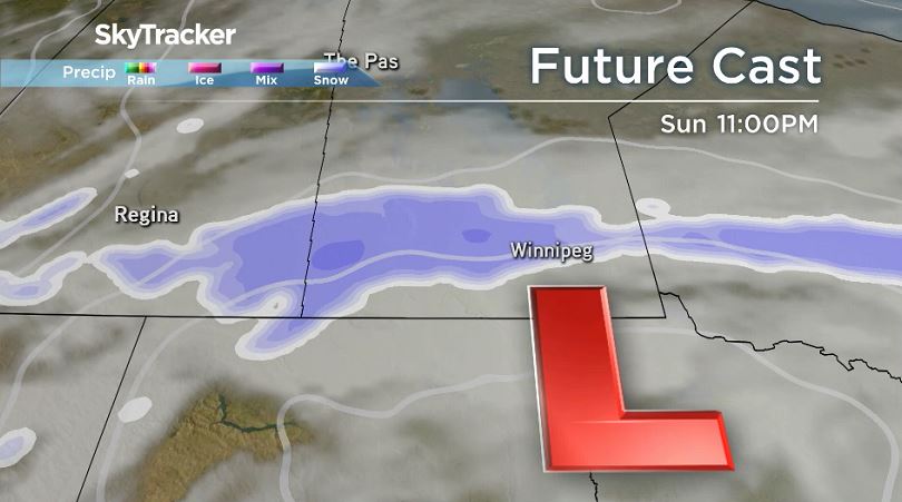
Sunday and into Monday, a Colorado Low is expected to make its way into the eastern Prairies. Snowfall amounts still vary as the system has not yet fully developed but expect snow and strong winds late this weekend and into Monday.
As of Friday afternoon here are varying snow totals expected for Winnipeg. The GEM model has around one centimeter falling mostly on Monday. The GFS model is expecting higher amounts, around 8 cm with snow starting Sunday afternoon. And the NAM model has nearly 3 cm of snow with flurries Sunday afternoon and some light snow Sunday night. The highest amounts will likely fall south of the border or in northwestern Ontario.
RELATED: Winter weather forecast: What Canadians can expect from coast to coast
Where there is agreement is in the wind speeds and direction on Monday. Winds near 40 to 50 km/h from the northwest will usher in much cooler temperatures. According to Environment Canada and Climate Change Canada, this will bring an end to the stretch of relatively mild conditions over the southern prairies with temperatures dropping back below seasonal.


Temperatures Wednesday morning could be close to -20 degrees Celsius in Winnipeg.
As Friday, the average temperature range is from -16 C to -7 C.

Comments