

UPDATE: All weather warnings mentioned in this story have ended

Saskatoon makes it above freezing for the second time this November!
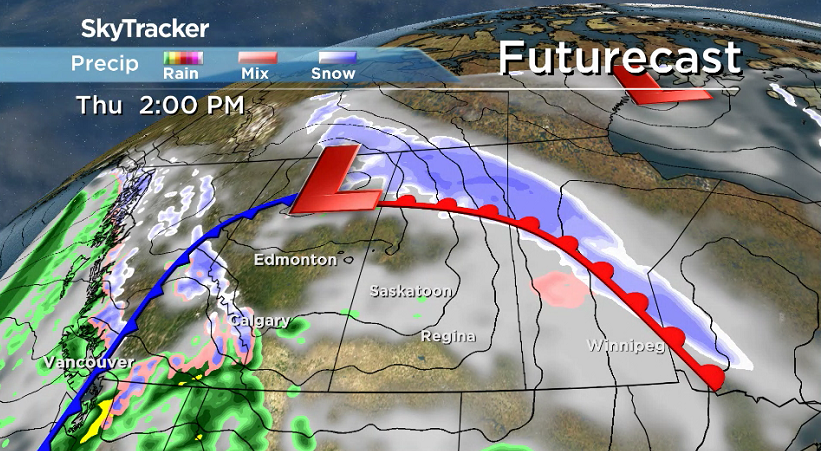
Freezing Rain Warning
Environment Canada has issued a freezing rain warning in La Ronge, Buffalo Narrows and Pelican Narrows.
The freezing rain will begin to dissipate Thursday afternoon and end by early Thursday evening.
Snowfall Warning
A snowfall warning has been issued in extreme northern Saskatchewan for 10 to 15 centimetres of snow expected.
A low pressure system over northern Alberta will spread snow into northern Saskatchewan before gradually tapering off Thursday evening.
Strong winds that may cause damage are expected or occurring.
Wind Warning
Environment Canada has issued a wind warning for Leader, Swift Current and Cypress Hills for strong winds that may cause damage.
Severe wind gusts exceeding 90 km/h are forecast to develop Thursday afternoon over southwestern Saskatchewan as an area of particularly strong winds moves into the region from Alberta before diminishing this evening.
For the latest weather alerts download the Global News Skytracker weather app for iPhone, iPad or Android.
Saskatoon Forecast
Thursday
Mist and clouds started the day in Saskatoon with conditions remaining just dry enough to keep thick fog from forming as we dipped back to -9 with wind chills in the mid-minus teens.
Mostly cloudy skies stuck around through the morning with a warm south-southeasterly wind kicking in and heating up to -3 degrees before noon.
Above freezing temperatures move in during the afternoon with that breezy warm wind continuing under mostly cloudy skies as we sit in the warm sector of a low pressure system swinging into the north.
Thursday Night
A good chance of rain moves in this evening as we remain above freezing as a cold front approaches and then swings through, kicking up winds to 30 km/h with gusts upwards of 50 to 60 km/h overnight.
They will be a cold northwesterly wind that’ll drop us back a few degrees below freezing as we get into some clear breaks at times overnight.

Friday
Strong west-northwesterly winds will continue in the morning with gusts pushing 50 km/h at times, making it feel like minus double digits to start before they ease during the day.
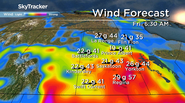
Mostly cloudy skies will stick around in the morning before some sunshine moves in later on as we rise up to an afternoon high around the freezing mark.


Weekend
Some sunshine is expected to start the weekend on Saturday with some more clouds building in Sunday as an upper ridge of high pressure keeps us from cooling down too far.
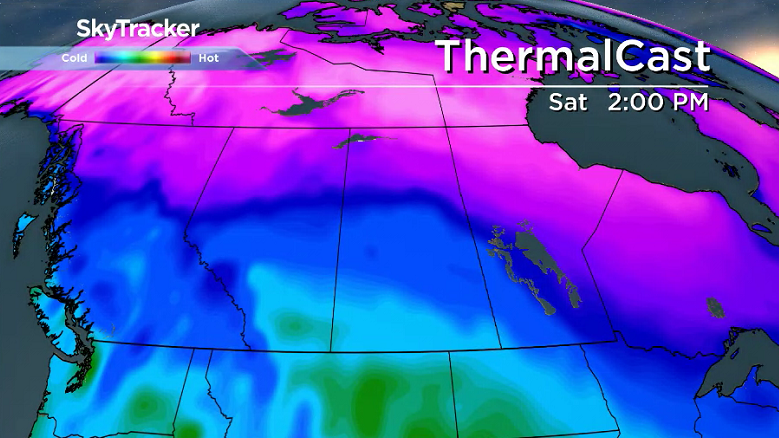
Daytime highs are expected to be around the freezing mark both days with morning lows dipping back into minus double digits.
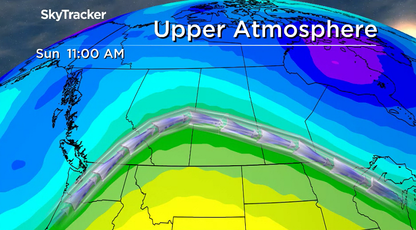
Work Week Outlook
The next system is slated to slide in early next week with mild air ahead of it on Monday before cooler air drops in behind it, with a chance of snow as it passes through.

Sharon Bryant took the Nov. 23 Your Saskatchewan photo in Earl Grey:

READ MORE: Get a 2018 Your Saskatchewan Calendar today
Saskatoon weather outlook is your source for Saskatoon’s most accurate forecast and is your one stop shop for all things weather for central and northern Saskatchewan with comprehensive, in depth analysis that you can only find here.
- ‘Shock and disbelief’ after Manitoba school trustee’s Indigenous comments
- Canadian man dies during Texas Ironman event. His widow wants answers as to why
- Several baby products have been recalled by Health Canada. Here’s the list
- ‘Sciatica was gone’: hospital performs robot-assisted spinal surgery in Canadian first
Comments