

Snow, snow and more snow with temperatures up, down and all around.

Saskatoon Forecast
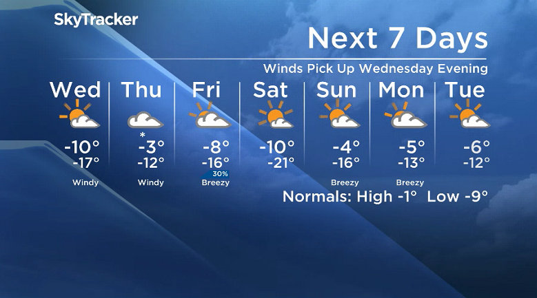
Tuesday
Mist started the day in Saskatoon as temperatures dipped back to -12 to start the morning with wind chills making it feel like -16.
Then the snow kicked in, falling quite heavily through the late morning, and coupled with 20 to 30 km/h north-northwesterly winds, dropped visibility down as low as 1.2 kilometres at times.
Light snow continued through the afternoon as we warmed up to an afternoon high in mid-minus single digits with breezy north-northwesterly winds.

Get daily National news
Tuesday Night
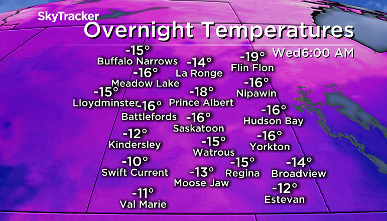
The low that brought the snow will slide out Tuesday night and the clouds will follow along with it eventually into early Wednesday morning as we cool back into the mid-minus teens.
Wednesday
-26 is around what it’ll feel like with wind chill as you head out Wednesday morning with a mix of sun and cloud that will continue until later in the day as a deck of clouds roll back in.


An arctic high dipping into the north will keep conditions cool, with an afternoon high around -11 degrees as southeasterly winds kick in, which will make it feel around -20 all day with wind chill.
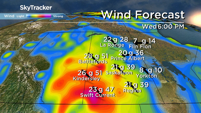
Southeasterly will continue to strengthen Wednesday night to around 30 km/h with gusts upwards of 50 to 60 km/h, which will keep temperatures from falling back as a system pushes in.
Thursday-Friday
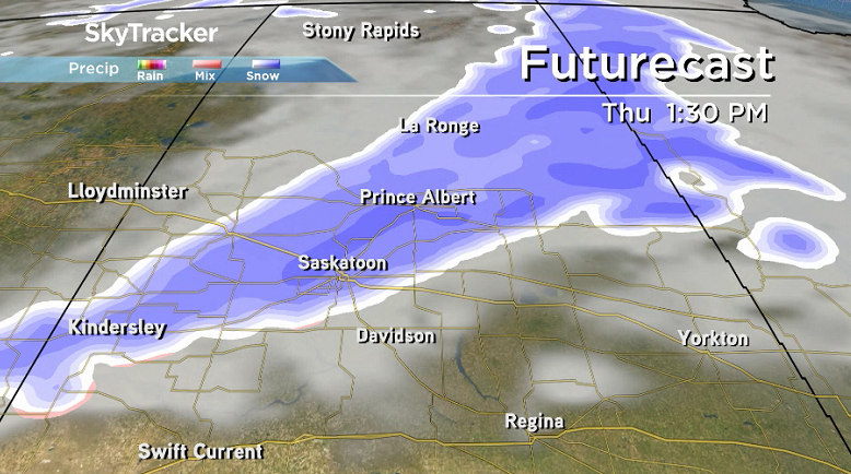
Snow associated with that system will slide through on Thursday, potentially bringing five to 10 centimetres worth of the white stuff to the city with winds gusting in excess of 50 km/h and a daytime high just a few degrees away from the freezing mark.
Friday will be a recovery day as cooler air slides back in under mostly cloudy skies before skies clear out late in the day with a daytime high struggling to get into minus single digits.
Weekend Outlook
-30 is where the weekend will start with wind chill Saturday morning as temperatures dip back into the -20s with a mostly sunny day helping warm us up to around -10, with an even warmer day on tap for Sunday under partly cloudy skies with a daytime high in mid-minus single digits.
Brenda Gawluk took the Nov. 14 Your Saskatchewan photo near Lanigan:

Saskatoon weather outlook is your source for Saskatoon’s most accurate forecast and is your one stop shop for all things weather for central and northern Saskatchewan with comprehensive, in depth analysis that you can only find here.


Comments