
Monday, October 30, 2017 – Weather forecast update at 4pm:

After several days of dry weather, we are on the cusp of a weather pattern change.
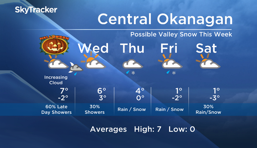
Expect increasing and thickening cloud with windy conditions at times Tuesday. Precipitation will move from north to south, with areas in the Shuswap and Columbia regions getting a few showers by the afternoon.

Get breaking National news
The Okanagan will start to see showers late afternoon and evening on Tuesday, with a brief reprieve from the precipitation on Wednesday.
Trick or treaters take note as showers are possible for many areas by the Tuesday evening hours with breezy conditions for some areas.
Cooler air will also start to move in Wednesday. This will bring freezing levels near the valley base, with the potential for a mix of rain and snow at valley bottoms by Thursday.


Tuesday’s daytime high range: 4 to 10C
We will have the rest of your weather details coming up at 5, 6:30 and 11pm – Hope you can join us!
~ Duane/Wesla


Comments
Want to discuss? Please read our Commenting Policy first.