

20 degree heat will be in full force ahead, but October begins with a bang!

Saskatoon Forecast
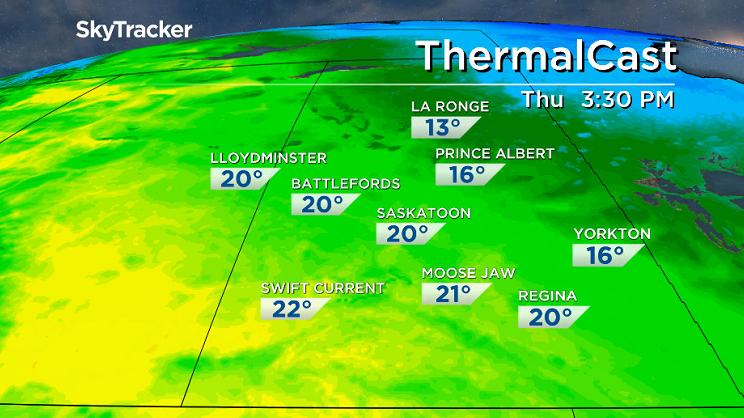
Thursday
Saskatoon fell to 3 degrees above freezing with partly cloudy skies to start the day.
Clouds then rolled in through the morning with an upper disturbance bringing in a few showers that started just before noon as we warmed into the mid teens.
Scattered showers continued into the afternoon under mostly cloudy skies as we rose up to a daytime high around 20 degrees.
Thursday
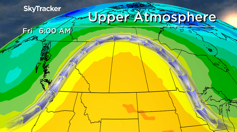
A mix of sun and cloud will start off our Thursday in the city with more and more sunshine moving in during the afternoon.
A big upper ridge of high pressure will be one of the reasons why clouds will get carved out and will also help boost temperatures into the low 20s later in the day.
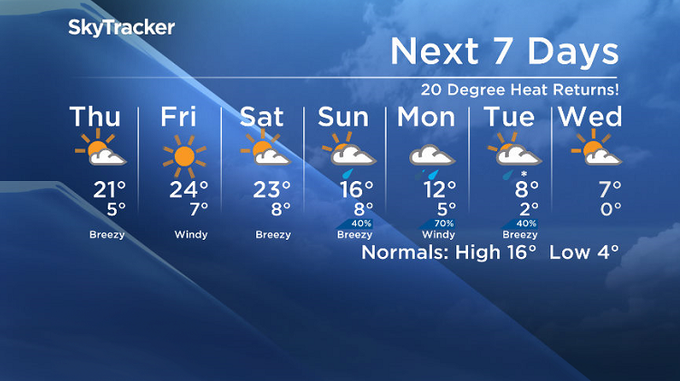
Friday
The heart of the heat will be hit as we slide into the core of the upper ridge to end off the week under blue skies and sunshine.
The mercury will climb up into the mid 20s in the afternoon with a southeasterly wind picking up through the day.
Weekend Outlook
The upper ridge of heat starts to slide out on Saturday as a system slides in from Alberta, bringing in some clouds on Saturday with a daytime high still making it into the 20s.
As the low pressure system and upper trough move right in on Sunday we’ll see predominantly cloudy skies with a good chance of rain, especially later in the day.


Heavy rain will move in on Monday with a chance that the mid-levels of the atmosphere could cool enough to see the precipitation switch over to some wet snow on Sunday that we’ll be keeping a close eye on as the date approaches.
Dale Wolkowski took this Your Saskatchewan photo in Bertwell:

Saskatoon weather outlook is your source for Saskatoon’s most accurate forecast and is your one stop shop for all things weather for central and northern Saskatchewan with comprehensive, in depth analysis that you can only find here.
Comments