

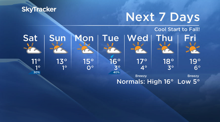
Cool start to fall, but what is the overall trend expected to be heading into winter?

Sizzling Summer
Saskatoon saw more sizzling heat this summer than we have in years.
The city spiked up into the 30s a total of 16 times in 2017, that’s over five times the three days we saw last year!
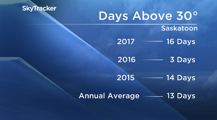
On average, the Bridge City sees 13 days of 30 degree heat in a year.
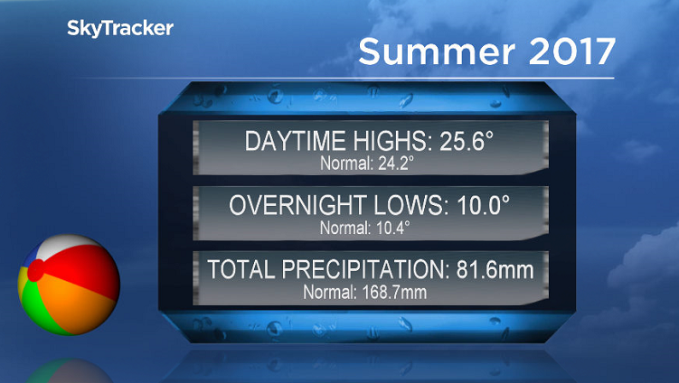
Precipitation-wise, the season was well below normal with less than half of our normal rain throughout the period.
September has seen near normal rain with the heaviest one-day rain event the city has seen in years reported on Tuesday, Sept. 19.
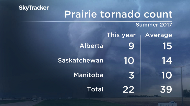
Severe weather-wise, a total of 10 tornadoes were reported in the province, when on average we see approximately 14.
Fall Forecast
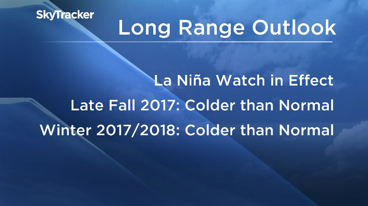
Seasonal forecasting is tricky, however there are early indications of cooler than normal waters off the coast of Peru, which would hint at a colder than normal trend moving in ahead.
The National Weather Service in the United States has issued a La Niña watch, which means there is an increasing chance (~55 per cent to 60 per cent) of a La Niña to develop in the fall and winter.

What that would mean for central Saskatchewan if it does develop, is that cooler than normal temperatures would be expected on average for the end of fall and into winter.

Get daily National news
That isn’t to say that we won’t see warmer than normal days, but when averaging out multiple months of data, this would just be the overall trend.
At this point there are no strong precipitation-trends apparent in either direction.
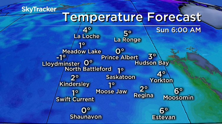
Saskatoon Forecast
Friday
Frost started the final morning of summer in Saskatoon as temperatures dipped back to -1 overnight under partly to mostly cloudy skies.
A few spatterings of light rainshowers passed through the city this morning as we rose up into mid-single digits.
Fall officially starts in Saskatchewan at 2:01 p.m. and will be run in with mostly cloudy skies and a chance of showers for the remainder of the day as we aim for a daytime high just into low double digits.


Friday Night
Mostly cloudy skies with a chance of showers will continue into Friday night as we cool back toward the freezing mark with a risk of frost.
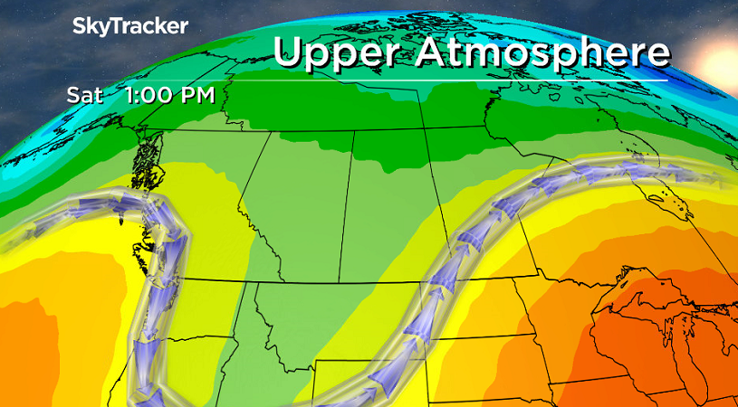
Saturday
The first full day of fall will kick off on a cloudy note on Saturday with a slight chance of showers or drizzle throughout the morning and afternoon.
The upper trough we sat in all week will also keep conditions cool, but we should be able to make it up to a daytime high just into low double digits again.
Sunday
Some clouds are expected at times during the day on Sunday with some sunny breaks also possible, especially in the afternoon.
As the cool upper trough pushes east a bit, we should also manage to get a bit warmer with an afternoon high flipping up into the low teens after starting off around the freezing mark with a risk of frost in the morning.
Work Week Outlook
A mix of sun and cloud will kickoff the first full work week of fall before clouds with a risk of rain return on Tuesday with daytime highs in the mid teens both days.
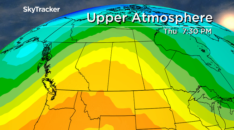
Warmer air will finally move back in for the rest of the week as an upper ridge brings us back into some more sunshine and daytime highs bumping up into the upper teens.
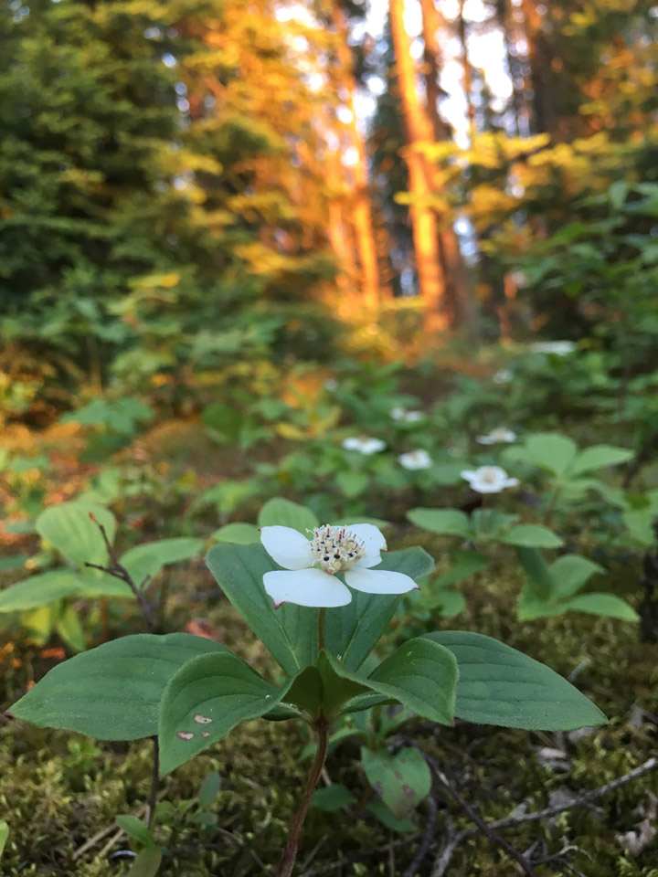
Brian Borisko took this Your Saskatchewan photo for September 22 at Lower Fishing Lake:
Saskatoon weather outlook is your source for Saskatoon’s most accurate forecast and is your one stop shop for all things weather for central and northern Saskatchewan with comprehensive, in depth analysis that you can only find here.
Comments
Want to discuss? Please read our Commenting Policy first.