

Clouds come back for the weekend with more risks of frost ahead.

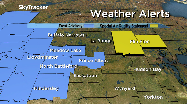
Frost Advisory
Environment Canada has issued a frost advisory west and north of Saskatoon for Prince Albert, Biggar, North Battleford, Meadow Lake, Lloydminster, Kindersley and Rosetown.
The agency says frost may damage some crops in frost-prone areas and is likely to develop tonight as a ridge of high pressure remains entrenched over central areas of Saskatchewan.
As skies clear under the ridge Friday evening, temperatures are expected to reach the freezing mark with frost likely.
Areas under patchy cloud overnight may see some local temperatures remain above zero.
Environment Canada recommends taking preventative measures to protect frost-sensitive plants and trees.
Saskatoon Forecast
Today
Saskatoon managed to scrape into the morning without seeing any frost or sub-freezing temperatures thanks to clouds that stuck around just long enough for the sun to rise.
Other areas north of the city weren’t as fortunate, with Prince Albert, North Battleford, Meadow Lake and Melfort all falling below freezing as clouds cleared a bit more, which did however provide some spectacular views of the northern lights.
After warming up into double digits by mid-morning under a mix of sun and cloud we will continue climbing a few more degrees into the low teens as clouds bubble up and build in during the afternoon.

Get breaking National news
Tonight
Overcast skies will push back in overnight as we dip back into mid single digits once again.
Saturday
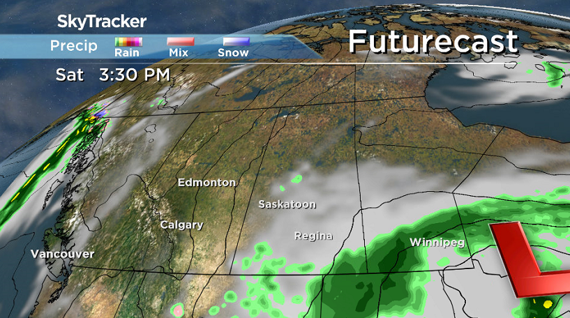
A system sliding into southern Manitoba and northern Ontario will keep the city in the clouds right through the day.


Temperature-wise we should climb back up into the mid teens by afternoon.
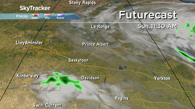
Sunday
As the system that brought the clouds in pushes east on Sunday, we’ll see more sunshine move into the Saskatoon area for the day.
The mercury will also spring back up after a risk of frost in the morning to an afternoon high around 16 degrees later on.
Work Week Outlook
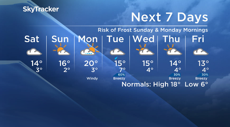
A kick of heat will move in on Monday ahead of a system moving into Alberta, which should help boost us into the 20s during the day as clouds roll back in.
That system will then swing through on Tuesday and bring with it a good chance of rain and drop daytime highs into the mid teens with clouds lingering into the middle of the week.
Alie Neish took this Your Saskatchewan photo in Naicam:

Saskatoon weather outlook is your source for Saskatoon’s most accurate forecast and is your one stop shop for all things weather for central and northern Saskatchewan with comprehensive, in depth analysis that you can only find here.
Comments
Want to discuss? Please read our Commenting Policy first.