
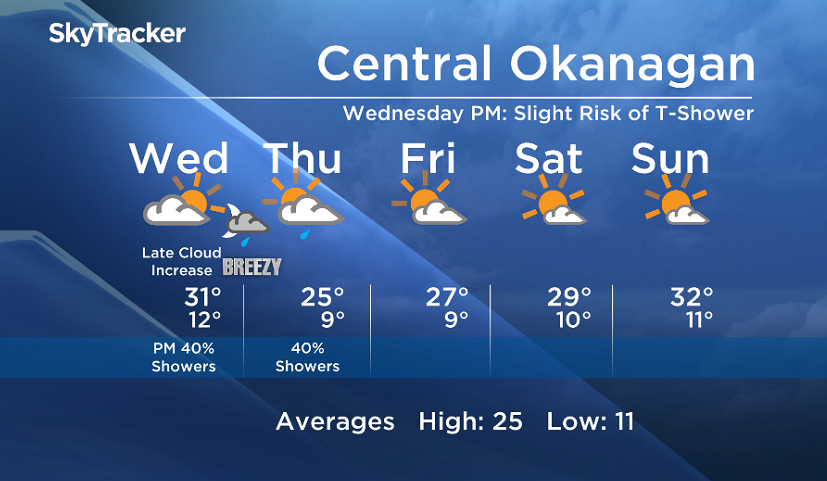
Wednesday, August 23, 2017 – Weather forecast update at 5am:

Another warm day ahead today but a change is on deck tonight. A cold front will cross the region tonight and Thursday to bring us some cloud and a slight chance of showers over the next couple of days. There will also be a slim possibility of an isolated thundershower this afternoon and evening. The wind will also be gusty at times.
Breaking news from Canada and around the world
sent to your email, as it happens.
The weather pattern will start to restabilize Friday, just in time for a warm and sunny weekend.


Today’s daytime high range: 27C to 35C
We will have the rest of your weather details coming up at 5, 6:30 and 11pm – Hope you can join us!
~ Duane/Wesla
More on Canada
Comments