
The City of Williams Lake is under an Evacuation Alert as weather is expected to push fires burning west of the city toward it at a “rapid pace” on Wednesday.

No one knows for certain what the weather will look like; but smoke forecaster BlueSky has given people some idea of how smoke patterns could arrange themselves.
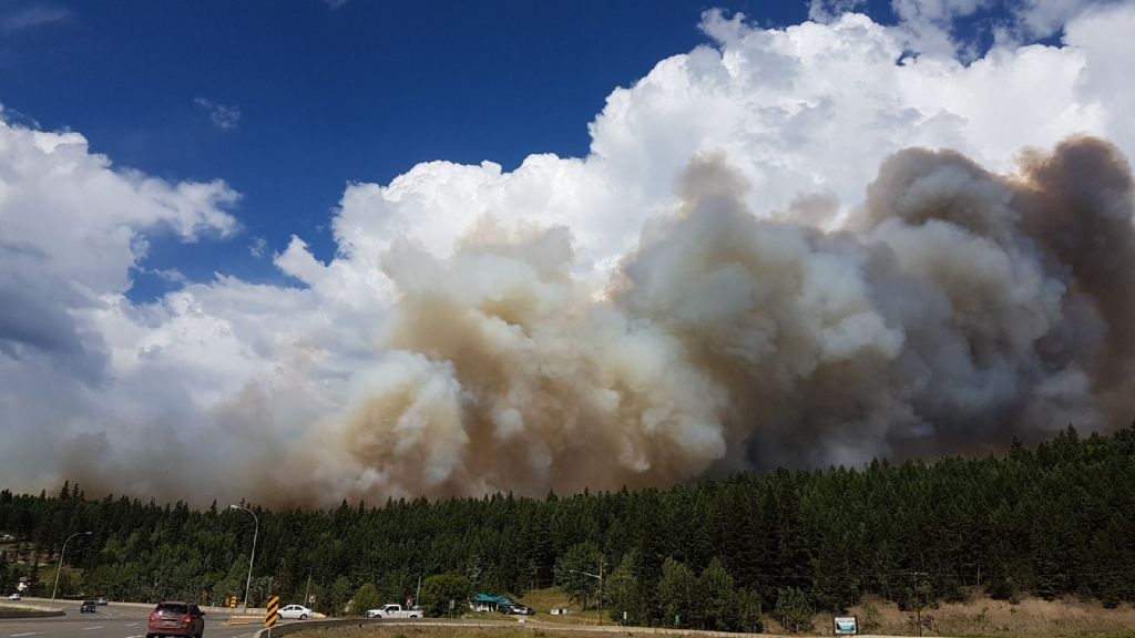
Coverage of wildfires around Williams Lake on Globalnews.ca:


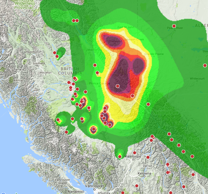
The forecaster, which is operated with the support of UBC, the federal government and some provincial governments, shows thick smoke sitting over Williams Lake and surrounding areas on Wednesday.
It then shows smoke blowing eastward throughout the day, though plenty remains over B.C.
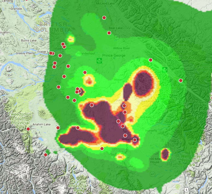
The forecast for smoke patterns over B.C. at midnight on July 12:
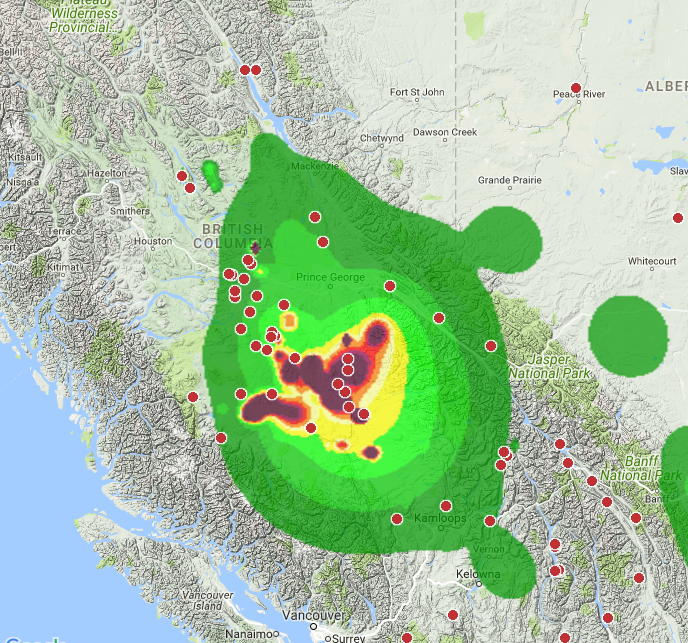
The forecast for smoke patterns over B.C. at 8 a.m. on July 12:
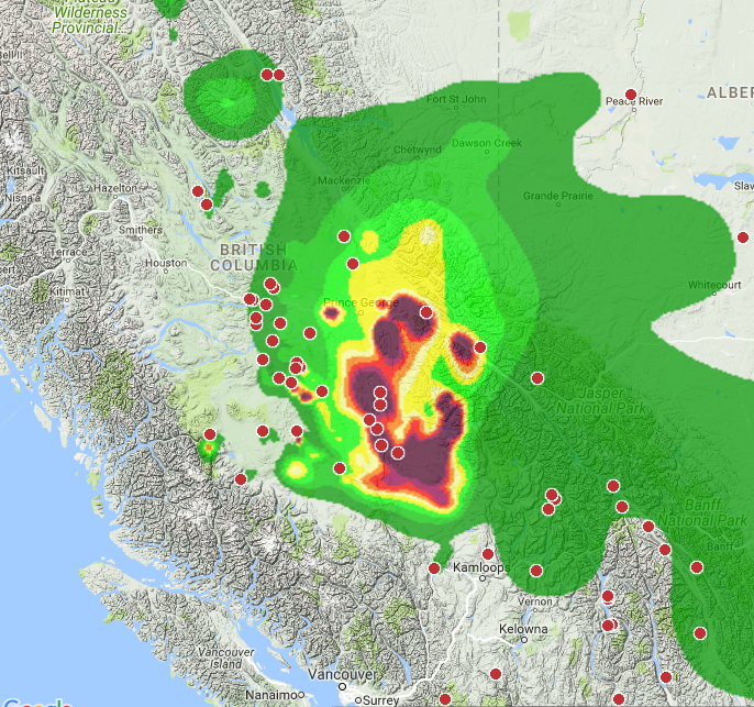
The forecast for smoke patterns over B.C. at 2 p.m. on July 12:


BlueSky comes up with its forecasts by using a weather forecast model for Western Canada out of UBC, as well as info from the Canadian Wildland Fire Information System based at the Northern Forestry Research Centre in Edmonton.
The information is processed at UBC and BlueSky then creates hourly animations of smoke plume trajectories and concentrations of small, dangerous particles.

Get breaking National news
The red parts on the forecasts represent heavier concentrations of those particles, while the red dots are wildfires.
READ MORE: B.C. wildfire photos: images show devastation as fires ravage parts of B.C.
BlueSky warns that it provides info for “research purposes only,” and that modelling may be “inaccurate for a variety of reasons.”
But it nevertheless provides a stark, overhead picture of a wildfire situation that has seen over 14,000 people forced to flee their homes as of Tuesday.
A number of wildfires are concentrated near Williams Lake; numerous fires that are burning in the Hanceville area have together been estimated at 10,000 hectares, while the Wildwood/Williams Lake Airport fire has been estimated at 2,500 hectares.
Williams Lake residents have been advised to pack ID, clothing and medicine that would be enough for at least three days, in case the city is evacuated.
A reception centre has been established in the city at the Carson campus of Lake City Secondary School, at 640 Carson Drive.
Comments
Want to discuss? Please read our Commenting Policy first.