

After Saskatoon’s warmest morning of 2017 so far, the weather pattern changes for the rest of the week.

Saskatoon Forecast
Today
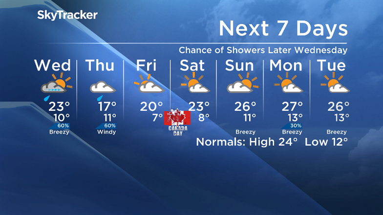
This was Saskatoon’s warmest morning so far this year with temperatures only dipping back to 16 degrees to start the day!
Partly to mostly cloudy skies overnight helped hold in the heat, coupled with an upper ridge moving through, which helped quickly warm us up into the mid 20s by late morning today.
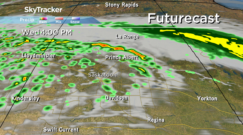
An approaching cold front will swing around the winds to the northwest at 30 to 40 km/h with gusts of 50 to 60 km/h possible as we hit a daytime high around 26 degrees with a risk of afternoon thunderstorms.

Get breaking National news
Tonight
Clouds will clear back out overnight as we cool back to an overnight low around 10 degrees or so as winds ease back off.
Wednesday
Some sunshine should start our day on Wednesday before clouds build back in with a good chance of rain and risk of a thunderstorm in the afternoon and evening as an upper low pushes in.
West-southwesterly winds will kick up slightly during the day, helping to warm us back into the low 20s by noon before topping out around 23 degrees for a daytime high.
Thursday-Friday
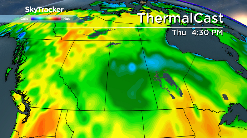
That upper low will continue its trek through the area on Thursday, keeping us cloudy, cool and wet with a good chance of rain during the day and an afternoon high around 17 degrees.
That system slides out on Friday, giving us a break from the rain with some lingering cloud cover, however some sunny breaks are possible and we should climb up to a daytime high in the low 20s.


Canada Day 150 Long Weekend Outlook
The big Canada 150 long weekend is looking not too shabby at all!
For Canada Day on Saturday, a mix of sun and cloud can be expected as we warm up to a daytime high around 23 degrees or so.
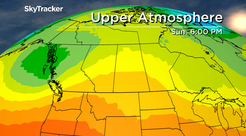
A few more clouds look to push in with a slight chance of late day showers or thunderstorms on Sunday, however we’ll warm up a few degrees further into the mid 20s for an afternoon high around 26 degrees.
Then we may get into a big more sunshine, especially early in the day on holiday Monday, with a daytime high around 26 or 27 degrees.
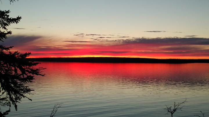
This Your Saskatchewan photo was taken by Cameron and Paul Green at Waterbury Lake:
Saskatoon weather outlook is your source for Saskatoon’s most accurate forecast and is your one stop shop for all things weather for central and northern Saskatchewan with comprehensive, in-depth analysis that you can only find here.
Comments
Want to discuss? Please read our Commenting Policy first.