Howling winds blast through the province with rain added in today before a change moves in for the weekend.

Saskatoon Forecast
Today
6 hours of light rain started the day in Saskatoon, which is much needed moisture, especially given that we’ve only seen 21 per cent of our normal June precipitation.
Temperatures slid back to 9 degrees this morning before rising up to the low teens before noon as northwesterly winds continue to gust upwards of 40 km/h.
Only 21% of Saskatoon’s normal rainfall has fallen so far this June with approximately 14.1 millimetres reported at the airport, and ~52 millimetres more needed to reach our average monthly rainfall total of 65.8 millimetres.
June is normally the wettest month of the year in Saskatoon.

Get breaking National news
Cool northwesterly winds will remain around 30 to 40 km/h with gusts pushing 50 to 60 km/h this afternoon as light rain eventually eases off and we rise up a few more degrees into the mid-teens.
Tonight
As the wrap around moisture that brought the rain moves out, clouds will follow overnight and winds will also ease back to around 25 km/h with gusts upwards of 40 km/h as we cool down to 5 degrees.
Friday
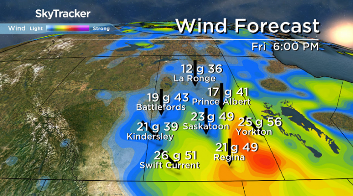
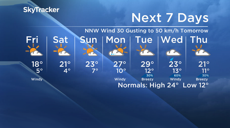
Sunshine will start the day on Friday as a north-northwesterly wind holding around 20 to 30 km/h with gusts upwards of 50 km/h keeps things cool during the day with a daytime high around 18 degrees.
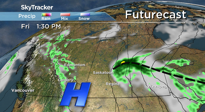
An upper low skirting through eastern Saskatchewan will bring rain to that part of the province and is expected to build in some clouds into the Saskatoon area during the day.
Weekend
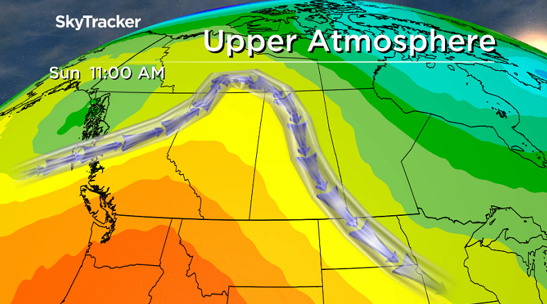
An unsettled northwesterly flow will continue aloft this weekend, which means we’ll likely see clouds in and out both Saturday and Sunday with a very slight chance of showers here and there.
Winds will finally ease off as temperatures return to the low 20s on Saturday before pushing up a bit further into the mid 20s for Sunday as a surface high and some upper ridging build in.
Work Week Outlook
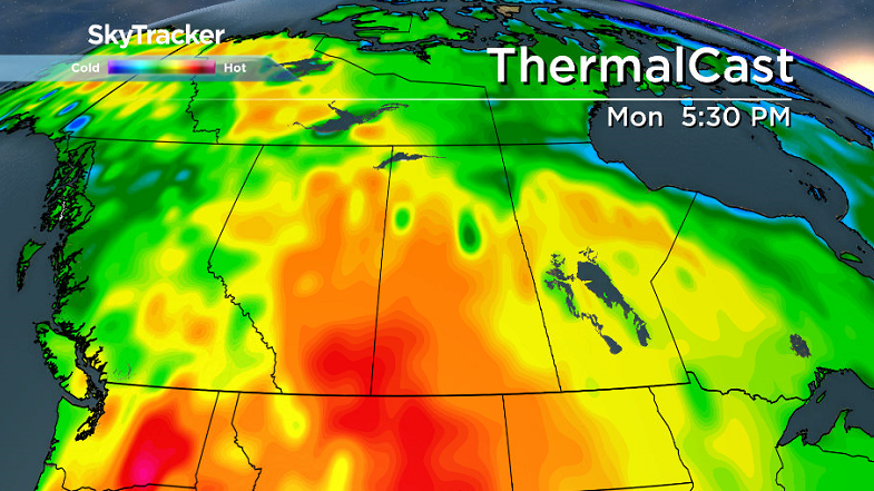
We see even more heat push in for the start of the work week as the upper ridge moves right in over the area and daytime highs push up into upper 20s with some clouds moving in along with a system mid-week that’ll eventually cool us back down.
There are early indications of a late month heavy rainfall mid-week as that system slides through with an upper low potentially stalling over our area, which we will keep an eye on and update the situation as the date approaches, however the moisture would definitely put a dent into our June rain deficit.
This Your Saskatchewan photo was taken by Chris Shinkewski at Island Falls:
Saskatoon weather outlook is your source for Saskatoon’s most accurate forecast and is your one stop shop for all things weather for central and northern Saskatchewan with comprehensive, in-depth analysis that you can only find here.







Comments