
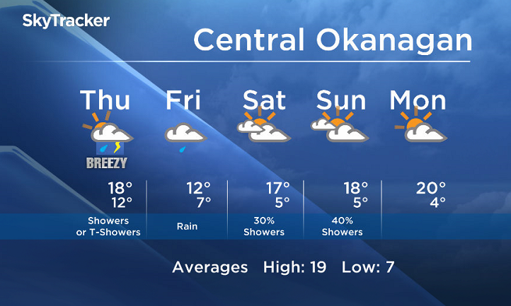
Wednesday, May 10, 2017 – Weather forecast update at 5pm:

A transition to a wetter pattern starts tomorrow. A cold front will slowly push through the BC Interior with showers and the risk of thundershowers Thursday.

Get daily National news
Get the day's top news, political, economic, and current affairs headlines, delivered to your inbox once a day.
By providing your email address, you have read and agree to Global News' Terms and Conditions and Privacy Policy.
Showers will linger on Friday with the slow passage of this front.
An upper trough remains in the forecast this weekend, keeping a slight risk for showers in the forecast with sunny breaks in between.


Thursday’s daytime high range: 16 to 22C
We will have the rest of your weather details coming up at 5 and 6:30 and 11pm – Hope you can join us!
~ Duane/Wesla


Comments