

March is in like a lamb with a warm up, some snow and a cool down ahead.

Extreme Cold Warning
Environment Canada has issued an extreme cold warning for the Key Lake, Southend and Collins Bay areas for a period of very cold wind chills.
Extreme cold is expected to persist until Friday in extreme northern Saskatchewan with wind chills near -45 during the morning hours over the next few days.

For the latest weather alerts download the Global News Skytracker weather app for iPhone, iPad or Android.
February 2017 Facts
February ended up being way warmer than normal with temperatures 3.2 degrees above average.
Overall, daytime highs ended up being 2.5 degrees warmer than average and morning being the more notable of the two factors at a whopping 4 degrees milder than normal.
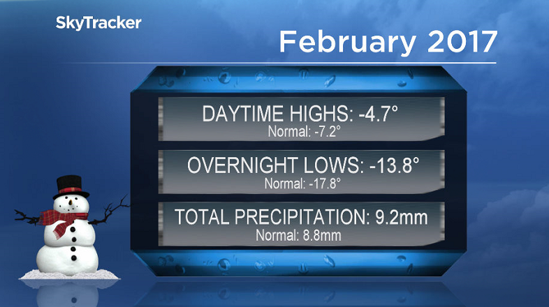
February was almost bang on average for precipitation, with 9.2 millimetres reported at the Saskatoon airport, when our normal is 8.8 millimetres through the month.
Saskatoon Forecast
Today
-27 is what it felt like this morning in Saskatoon with wind chill as clear skies allowed temperatures to drop back to -18.
Clouds moves back in this morning as we warmed up through minus teens up to -11 by noon.
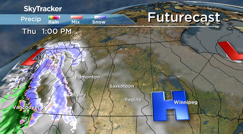
Light snow will begin this afternoon with a centimeter or so expected at most as a low pressure system slides by south of the area and we climb to an afternoon high just into minus single digits.
Tonight
Light snow is likely to linger into the evening before easing off overnight under predominantly mostly cloudy skies as we drop to a low around -18 once again.
Thursday
Wind chills in the mid -20s are expected again Thursday morning with a slight chance of flurries under mostly cloudy skies early in the day.
High pressure sliding by will help bring in some sunshine during the day with an afternoon high a few degrees into minus single digits and wind chills in minus double digits all day.


Friday
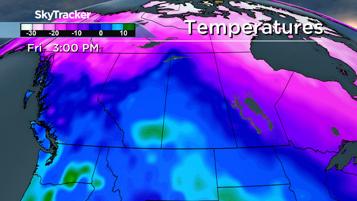
A big warm-up is on the way for Friday as a mild kick of air ahead of a low pressure system helps boost temperatures above freezing by a few degrees by afternoon under a mix of sun and cloud.
Weekend Outlook
Cooler air will slide in behind the system dropping us back below freezing on Saturday and back into the minus teens Sunday with a high in minus single digits.
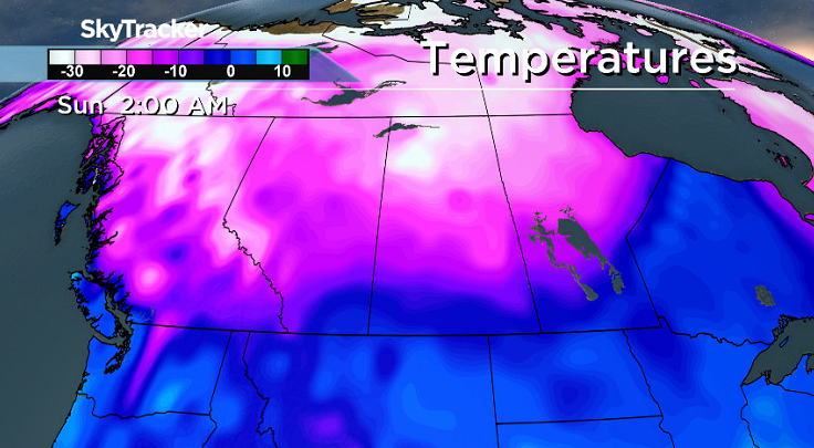
As we sit along or near the dividing line between the warm and cold air both days there is a good chance of snow later on Saturday and into Sunday.
This Your Saskatchewan photo of a bird herd was snapped in Watrous by Len:

Saskatoon weather outlook is your source for Saskatoon’s most accurate forecast and is your one stop shop for all things weather for central and northern Saskatchewan with comprehensive, in depth analysis that you can only find here.
Comments