Monday January 16, 2016
Weather forecast update at 5pm:
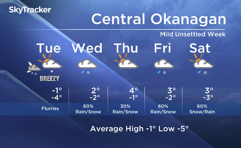
Good afternoon! Now that the Arctic air is retreating and a milder weather pattern is on deck, the switch to a southwesterly flow will drive in multiple weather systems into the Southern Interior this week.

Expect unsettled conditions with mixed precipitation over the next few days.

Get daily National news
Although there is some uncertainty on the timing of the precipitation, we are expecting a good chance of flurries Monday overnight into Tuesday for many areas, especially the northern and eastern regions of the Southern Interior.
With freezing levels rising, we expect the snow to change to rain by midweek.
Tuesday’s daytime high range: -4 to +2C
We will have the rest of your weather details coming up at 5pm, 6:30pm and 11pm – Hope you can join us!
~ Duane English / Wesla Wong


Comments