

Cold air plunges in behind today’s snowy system.

Saskatoon Forecast
Today
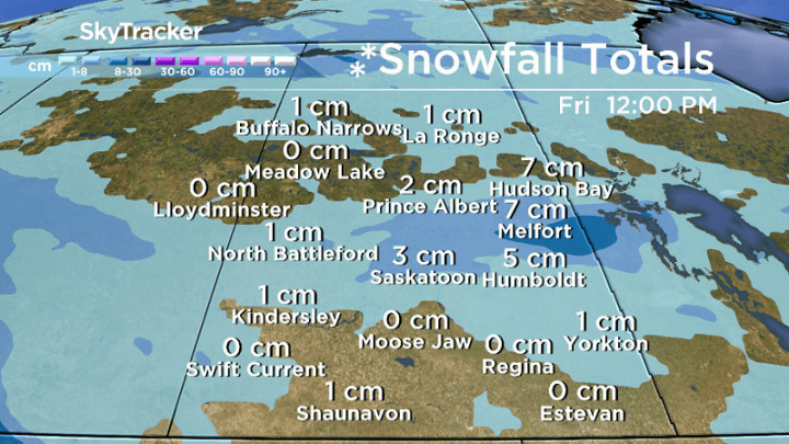
Light drizzle changed over to a rain-snow mix this morning as a low pressure system swung through.
The mixed precipitation then transitioned to snow by 9 a.m. that continued until just before the noon hour with temperatures sitting around the freezing mark through the morning.
Winds were breezy as the system slid through with gusts up to 50 km/h at times before easing off later on.
As of noon the precipitation has pushed out of the region and there were even a few sunny moments caught outside!
Mostly cloudy skies look to linger through the rest of the day with temperatures only topping out a degree or two above the freezing mark as cooler air moves in.
Tonight
Our first arctic blast of the month will be felt overnight as cool air sinks in behind the system under partly to mostly cloudy skies.


Get daily National news
Depending how much clearing we see tonight, temperature could fall anywhere from around -6 to as low as -8 degrees or so for an overnight low.
Thursday
Minus double digits is what it’ll feel like with wind chill when you head out tomorrow morning.
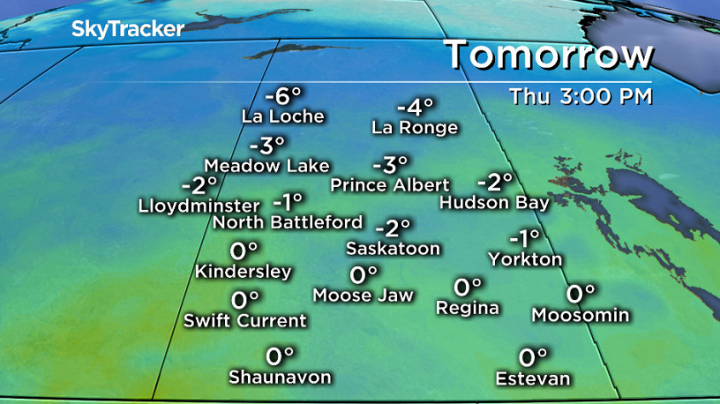
Mostly cloudy skies look like they’ll stick around throughout the majority of the day with the mercury not even recovering to the freezing mark, remaining just shy of it for a daytime high.
Friday
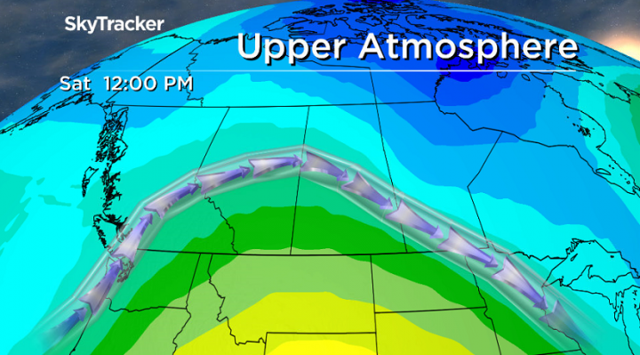
The cool air continues to plunge in right into the end of the week with a little more sunshine expected during the day.
Temperatures could drop as low as -8 to -10 in the morning with wind chill values making it feel like the mid-minus teens before recovering up to around -3 in the afternoon for a daytime high.
Weekend Outlook
Warmer air will try to push back in this weekend, but it will be tough.
Clouds will build back in during the day on Saturday after a cool start in minus double digits, so a daytime high of -2 looks reasonable for that day, which is actually Saskatoon’s normal daytime high for this time of the year.
A low pressure system pressing into Alberta will bring a chance of precipitation late Saturday into early Sunday and will also help push in even more heat on Sunday under a mix of sun and cloud, potentially allowing our daytime high to pop up above zero to finish off the weekend.
Bonnie Evanochko took this Your Saskatchewan photo near Maymont:

Saskatoon weather outlook is your one stop shop for all things weather for Saskatoon, central and northern Saskatchewan with a comprehensive look at your local forecast that you can only find here.
Comments
Want to discuss? Please read our Commenting Policy first.