

Snow is in the forecast for Saskatoon next week after a warm start to our first weekend of October.

Saskatoon Forecast
Today
Today started out around six degrees under mostly clear skies before temperatures pushed up into 17 degrees by noon under mostly sunny skies.
The sunshine is expected to stick around for the rest of the day as the mercury rises even higher up into the low 20s, making for a beautiful final day of September!
Tonight
Mostly clear skies will stick around tonight allowing temperatures to dip back to around seven degrees.
Saturday
October kicks off on a glorious note with a beautiful day filled with mostly sunny skies and just a few more clouds expected earlier in the day.
We’ll be in the warm sector of a developing area of low pressure through the day, helping our high climb up toward 23 degrees!
Then a cold front associated with the system slides through tomorrow evening, picking up the winds and bringing in a rain overnight into early Sunday morning.
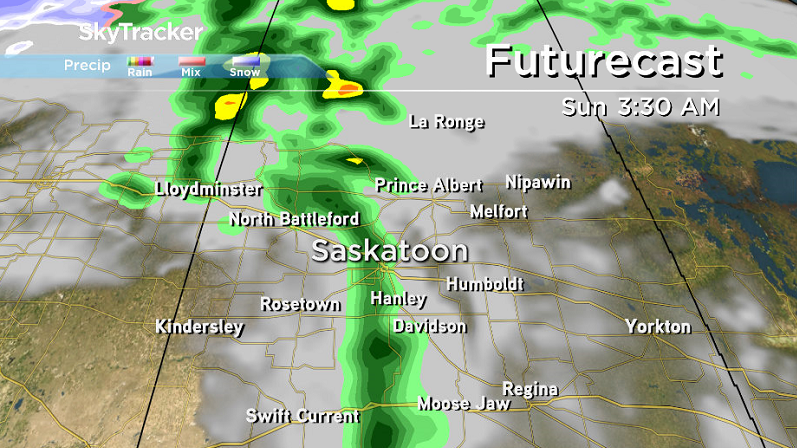
Sunday
We may see a few early morning sprinkles associated with the low pressure system’s cold front early Sunday before clouds clear out of the area, making for a beautiful and sunny remainder of the day.
Behind the front, conditions will be much cooler with a daytime high dropped back into the mid-teens and windy conditions sticking around.
Work Week Outlook
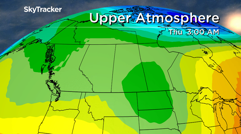
Monday will be the mildest day of the first week of October under partly to mostly cloudy skies with a high temperature in the mid-teens before the effects of an upper trough start to grip Saskatoon for the rest of the week.
Those effects include daytime highs dropping from low double digits Tuesday into mid-single digits Wednesday through Friday along with mostly cloudy skies and some precipitation.


The precipitation looks like it’ll stay in liquid form for Tuesday before switching to some snowflakes potentially on Wednesday.
Then on Thursday the atmosphere will have cooled enough to produce any precipitation that falls in snowflake form.
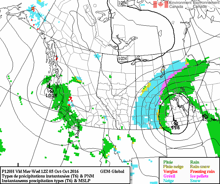
The main precipitation generator will be an upper low swinging by southeast of the region, so there is still a chance we may miss out on all of it, but models have been coming in ever increasing agreement over the snow in Saskatoon next week.
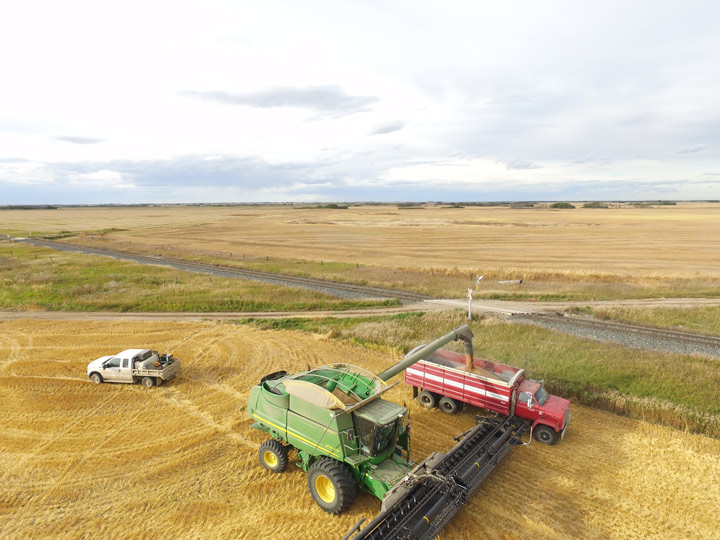
This Your Saskatchewan photo was taken by Melanie Lehnert at Landis:
Saskatoon weather outlook is your one stop shop for all things weather for Saskatoon, central and northern Saskatchewan with a comprehensive look at your local forecast that you can only find here.
Comments