

Snow is possible in northern Saskatchewan this weekend, frost with below freezing temperatures in Saskatoon early next week.

Saskatoon Forecast
Today
Saskatoon’s normal overnight low at this time of the year is seven degrees; this morning we started the day at five under mostly cloudy skies.
The mostly to partly cloudy skies lingered into the middle of the day with temperatures up around 17 degrees by noon.
Clouds will clear out of the area late in the day with a daytime high around 20 degrees expected once again today with winds picking up this afternoon to sustained speeds around 25 km/h with gusts upwards of 40 km/h.
Tonight
Whatever cloud cover that lingers today will clear out before it builds back in early tomorrow morning as temperatures fall back into mid-single digits.
Saturday


It’ll be a cloudy, but warm start to the weekend as a low pressure system sweeps into the north.

Get daily National news
We may catch some sunny breaks during the afternoon with a bit of clearing as temperatures rise up into the low 20s for a daytime high.
The cold front associated with the system will then start sweeping through Saturday night, bringing with it a good chance of rain from the evening into the overnight period.
Sunday
As the cold front continues to sweep through on Sunday, a mostly cloudy day is expected with a good chance of rain and a few sunny breaks possible in the morning into midday.
The mercury is expected to climb into the mid-teens with west-northwesterly winds at sustained speeds up to 30 km/h with gusts upwards of 45 to 50 km/h at times.
Extreme northern areas in the province could see precipitation switch over to snow early Sunday.
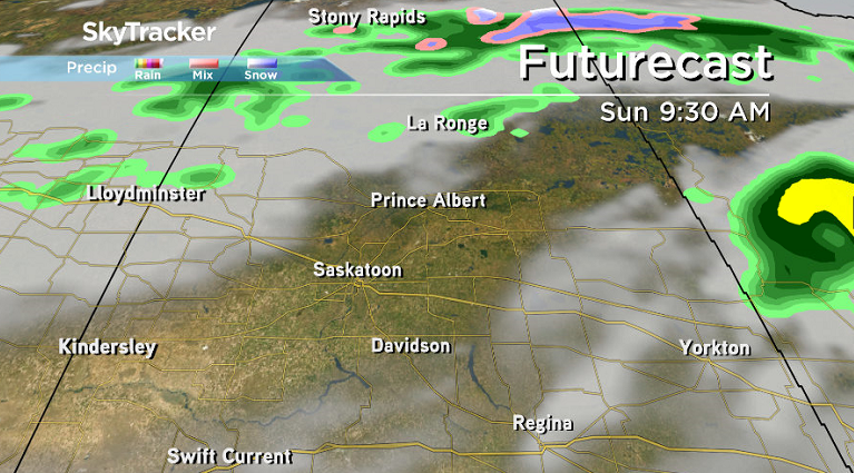
The northeastern corner is most at risk including the Collins Bay and Wollaston Lake areas, however with ground temperature above freezing, most of what falls should melt on contact with most surfaces.
Work Week Outlook
Monday could start off a bit breezy still before winds ease through the day and clouds clear out of the area with an afternoon high in low double digits.


Risk of Frost
Attention farmers, gardeners and anyone with frost sensitive plants!
We could see our first below freezing temperatures of the season on Tuesday morning in Saskatoon, bringing with it a risk of frost as an arctic high drops in.
Some low-lying areas outside the city could see the mercury fall a few degrees below freezing early Tuesday, with a good chance of a killing frost, particularly in low-lying areas.
Overnight lows will eventually recover back above freezing later in the week with daytime highs pushing back into the 20s by the middle-to-end of the week.
After a slightly warmer than normal summer, Global News is projecting a slightly cooler than average meteorological fall, which includes the months of September, October and November.
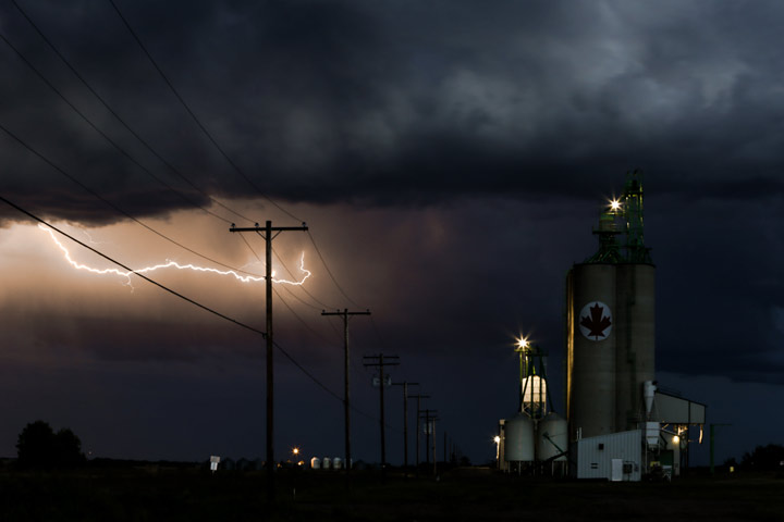
This Your Saskatchewan photo was snapped by Aleah Anseth outside Cut Knife:
Saskatoon weather outlook is your one stop shop for all things weather for Saskatoon, central and northern Saskatchewan with a comprehensive look at your local forecast that you can only find here.
Comments
Want to discuss? Please read our Commenting Policy first.