
Tuesday, September 06, 2016 – Weather forecast update at 4pm:

We will gradually start to dry out, but this process will take a bit of time.
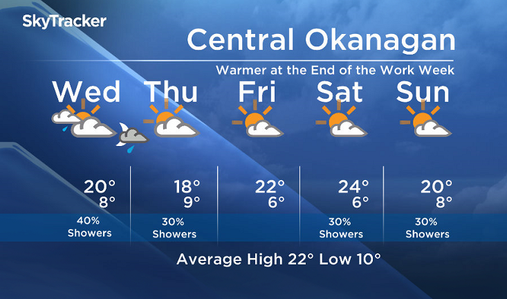
On Wednesday, sunny breaks are possible morning and midday, however as another system pushes inland Wednesday night, we will see increasing and thickening cloud again by Wednesday late afternoon and evening.

Get daily National news
Showers will once again be likely by Wednesday afternoon/evening for the Columbia and Shuswap. Isolated showers are also possible for the Okanagan, Boundary and the Similkameen regions late in the day on Wednesday.
Transition day will be Thursday with fewer showers and more sunny breaks, and Friday looks quite pleasant to end the work week.


As for the upcoming weekend, we are still hoping for some sun but the most recent weather models are now bringing a fast moving shot of cooler air inland. Our weekend forecast confidence remains low.
Wednesday’s daytime high range: 15 to 22C
We will have the rest of your weather details coming up at 5 and 6:30 and 11pm – Hope you can join us!
~ Duane/Wesla


Comments