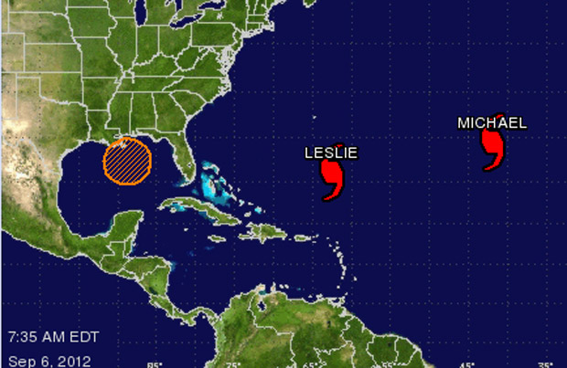
Updated at 6:15 p.m. NT/5:45 p.m. AT

Michelle Coughlin, of Newfoundland Power, said the utility was still trying to restore power to about 35,000 customers, primarily in St. John’s and Avalon. That’s an improvement from when there were 135,000 customers without electricity as Leslie was battering the island with its full force.
Coughlin said the company was aiming to have electricity back on in major areas, but some smaller communities may have to wait until into the day Wednesday before service is back to normal.
Trees were to blame for many of the outages, she said, adding that because the trees still had leaves on them, the “extremely high winds and heavy rain, made for heavy trees coming in contact with power lines… or the trees themselves coming down into the power lines and taking the power lines down with them, as well as our poles.”
Updated at 2:31 p.m. NT/2:01 p.m. AT
Leslie walloped downtown St. John’s Tuesday morning, leaving two of the city’s major streets – Water Street and Duckworth Street – covered in debris and closed off to motorists.
City spokesperson Jennifer Mills says the storm ripped parts roofs and facades off of office buildings in the downtown core and left glass and power lines strewn across streets.
According to Mills, between 12 and 15 streets closed throughout the city.


Newfoundland and Labrador’s capital city was on the eastern side of the post-tropical storm, which saw the most damaging winds. Western Newfoundland, on the other hand, got the bulk of Leslie’s rain.
At St. John’s International Airport, where several arrivals and departures were cancelled Tuesday, wind gust topped 130 km/h.
“We had a good four to five hours of sustained winds,” Mills said.
And while the storm may not have been as brutal as Igor, St. John’s emergency and city services lines were kept busy with a steady stream of incoming call.
Mills said the downtown appears to be the hardest hit area of the city at this point and public transit remains off the road for the time being.
“Our staff was really well prepared,” Mills said . “We’ve had guys going out dealing with all of the downed trees and we have all of our crews out dealing with the traffic lights that aren’t working.”
“We’re quickly working on getting the city back to normal,” she said.
City officials don’t have a timeline for when the area will be cleaned up.
Updated at 12:49 p.m. NT/12:19 p.m. AT
Leslie ripped the roofs off buildings and knocked down trees and power lines as it whipped over Newfoundland.
The centre of the post-tropical storm has moved into the Atlantic Ocean, moving to the northeast off Cape Bonavista at 72 km/h.
Leslie’s winds are still sustained at 110 km/h, according to the U.S. National Hurricane Centre.
Newfoundlanders are now left to deal with the aftermath.
The Canadian Hurricane Centre updated the situation in a 10:30 a.m. AT teleconference, saying wind gusts weren’t quite as strong as with hurricane Igor in 2010, but still delivering quite a blow to eastern parts of the island.
“There have been a fair number of reports of damage in the Avalon Peninsula,” said programs manager at the Canadian Hurricane Centre, Chris Fogarty.
South of St. John’s, Fogarty said, wind gusts topped 130 km/h. By comparison Igor brought winds as high as 172 km/h that, combined with heavy rainfall, devastated areas on the Burin, Avalon and Bonavista peninsulas.
But Fogarty says Leslie has not brought the same amount of precipitation that Igor did.
More details on the cleanup efforts to come.
Updated at 11:02 a.m. NT/10:32 a.m. AT
The mayor of Badger declared a local state of emergency Monday evening, ahead of Leslie blowing into Newfoundland.
The town’s water tower is empty and about to be dismantled. Officials fear Leslie’s tropical storm-force winds could blow the 24-metre high tower down.
Mayor Michael Patey said the steel tank stands on top of a hill, in the School Road area.
Patey said he ordered the evacuation of 23 homes on the street and asked for the Avoca Collegiate School to be closed all day Tuesday.
He added fire crews have blocked off the street.
“Our fire department has been there since 10:00 last night. Nobody gets in,” he said.
The tower was drained three weeks ago and the town has been working with the provincial Department of Municipal Affairs to have it removed.
Patey said the winds and rains associated with Leslie began picking up in the area around 6:00 a.m. NT.
Updated at 9:30 a.m. NT/9:00 a.m. AT
The Canadian Hurricane Centre confirms Leslie has made landfall on Newfoundland’s Burin Peninsula.
The centre of the storm came ashore in Fortune, on the southern tip of the peninsula, at 8:30 a.m. NT/8:00 a.m. AT.
The Canadian Hurricane Centre’s Chris Fogarty said in a phone interview Tuesday morning Leslie is transitioning to a post-tropical storm, but its intensity is still around hurricane strength.
Fogarty emphasized Leslie’s post-tropical status, saying the most threatening winds are 100 kilometres to the east of the centre and the heaviest rainfall will be as far as 200 kilometres to the west.
He said the rain will “fall over the elevated terrain, which increases the flooding risks.”
Because Leslie came in at low tide, the storm surge was not as intense as it could have been. CHC predicted Placentia Bay would experience the highest surf.

Get breaking National news
But, Fogarty explained, the highest waves tend to come in on the heels of the storm, after the centre passes.
Leslie is moving north over Newfoundland at a speed of 45 km/h, and should move out over Bonavista Bay within three hours, but the island will continue to feel the effect of the system.
“It will linger behind,” he said, “It’s going to be northwest winds, after that centre exits land,” he said adding the winds will die out as the storm moves out over the Atlantic Ocean.
CHC will hold a teleconference at 11:00 a.m. NT/10:30 a.m. AT to further update on the situation in Newfoundland, but Fogarty expects forecasters will cease updates on the storm later Tuesday afternoon.
Tuesday, Sept. 11 at 8:40 a.m. NT/8:10 a.m. AT
The list of areas experiencing power outages now includes:
– St. John’s – Conception Bay South – Mount Pearl – North Avalon – Southern Shore
including Sterling Crescent, Wedgeport Road, Newfoundland Drive, Mercers Drive, Yellowknife Street in St. John’s
– Whitbourne – Conception Bay North – Cape Shore and vicinity
including Trinity Shore, Whitbourne, Cape Shore, Conception Bay North, St. Mary’s Bay
– Stephenville – Port aux Basques
including Pine Tree Site, Port au Port East, Abrahams Cove and in the following areas of Stephenville: Queen Street, Beach Street, Bayview Street, Main Street, Kippens, Hillview Avenue, Hansen Highway, Grove Street, Gallant Street,
Empire Avenue, Colonial Street, Coldbrook, Area Thirteen, Brook Street, Whites Avenue, West Street, St. Stephen Street. St. George Avenue, Rose Avenue, St. Clare Avenue
The latest information on power outages can be found on the Newfoundland Power website.
Tuesday, Sept. 11 at 7:17 a.m. NT/6:47 a.m. AT
Wind and rain from tropical storm Leslie have begun to batter Newfoundland, but the centre of the storm is not expected to make landfall around 9:00 a.m. NT/8:30 a.m. AT.
The latest advisory from the Canadian Hurricane Centre (CHC) issued at 6:30 a.m. NT/6:00 a.m. AT said Leslie will move up through the island to Bonavista Bay, before it moves out to sea.
Leslie’s centre is located about 250 kilometres southwest of Argentia, but moving toward land at 65 km/h with sustained wind speeds of 110 km/h
According to the CHC, wind gust as high as of 95 km/h have been recorded on the Burin Peninsula. Stronger hurricane-strength gusts up to 122 km/h have been reported in Cape Pine, on the Avalon Peninsula.
Newfoundland Power has reported power outages in several areas of the Avalon Peninsula, including Branch, Freshwater, Placentia and Placentia Junction, Tors Bay, Bauline, Mobile, St. Michaels and Brunt Cove.
At St. John’s International Airport more than 25 arrivals and departures have been cancelled or delayed. Meanwhile outside the airport, 85 striking workers are walking a picket line before the effects of Leslie’s reach their full force.
The workers are responsible for maintaining equipment, clearing the runway, fire and emergency services.
Monday. Sept. 10 at 11:03 p.m. AT
Tropical storm Leslie’s winds are blowing strong, just below hurricane force, at 110 km/h.
As of 8:00 p.m. AT, Leslie was still 745 kilometres southwest of Cape Race, N.L., but the massive storm is now barrelling toward Newfoundland at 54 km/h, thanks to a trough of low pressure that is pulling the storm north.
The two systems are in fact interacting: the advancing tropical storm is keeping the rainmaker from moving off shore, while the trough is actually going to merge and increase the amount of rain Leslie dumps on Newfoundland.
Rainfall amounts could be as much as 150 millimetres over an 18 hour period, possibly washing out rods and creating treacherous driving conditions.
Although Leslie is not as strong as Hurricane Igor, two years ago, the effects of Leslie will be felt over a wider area.
Its winds stretch out 370 kilometres to the east and north from the centre of the storm, which is set to come ashore on the Burin Peninsula early Tuesday.
Forecasters at the Canadian Hurricane Centre warn Leslie’s storm surge could pack a punch for coastal areas of Placentia Bay, along the Burin and Avalon peninsulas.
The storm surge won’t be as high if Leslie’s arrival coincides with low tide in the morning.
But, an advisory issued at 9:00 p.m. AT said a “hazardous storm surge” is possible if Leslie accelerates and reaches the coast in time for high tide, around 4:00 a.m. NT.
The surf could reach between eight to 12 metres in the bay.
In other areas the waves won’t be quite as high: five to eight metres in along the east of the Avalon Peninsula and four to seven metres off the south west coast.
Monday, Sept. 10 at 9:38 p.m. AT
As mainland Nova Scotia got drenched with record breaking rainfall, ahead of tropical storm Leslie passing off the coast, Cape Breton braced for the possibility of its own dose of heavy rain, high seas and winds. Global’s Natasha Pace reports live from Louisbourg, N.S.
Monday, Sept. 10 at 9:19 p.m. AT
Kids across Newfoundland will be staying home from school Tuesday morning.
All school districts on the island have cancelled classes ahead of tropical storm Leslie bearing down on the Rock.
The Nova Central and Eastern Newfoundland School Districts have cancelled classes for the morning, but both jurisdictions will provide an update on the situation at 11:00 a.m. NT
All Eastern School District schools will be closed Tuesdaymorning due to tropical storm Leslie’s approach. Further update at 11am.


The Western Newfoundland and Labrador School District has cancelled classes for the morning as well, except at schools under its jurisdiction in Labrador.
WNLSD tropical storm is not expected to cause damaging conditions on the mainland and will keep the school open unless school or district employees advise otherwise.
Monday, Sept 10 at 9:04 p.m. AT
The Burin Peninsula looks to take the brunt of Leslie’s force, as the tropical storm moves ashore Tuesday morning.
Leslie’s maximum sustained winds have increased to 110 km/h, still below hurricane strength.
People living in the storm’s path spent Monday stocking up on supplies.
Marie Collins and her husband, Wayne, run Collins Superette in Lamaline – a community at the southern tip of Burin.
Marie Collins said in a telephone interview the store has been busy all day, but there’s still plenty on the shelves.
She said shoppers have stocked up on the usual rations of water, batteries, candles and the like.
But, it seems the residents of Lamaline were equally concerned with having comfort items on hand as they batten down the hatches.
“They’re getting lots of junk food. Some people are getting beer, cigarettes – definitely cigarettes,” she laughed.
Marie Collins said memories of the devastating blow Newfoundland got from Hurricane Igor two years ago next week, is still fresh in the minds of locals.
Lamaline didn’t get hit too hard during Igor, but some fear this time could be different.
“You know when people hear tell of a storm, everybody goes into panic mode. Especially where Igor was our first storm and we were hit quite hard,” she said.
“There’s not much you can do to prepare,” she explained. “Just make sure there’s nothing left out to blow around and just hope for the best.”
Further up the peninsula in Chapel Arm, Barry Power isn’t taking any chances with his business – Barry’s North Atlantic.
Two years ago the rain water from Igor came gushing down a hilll and into his store. This time around he’s piling up the sandbags taking the boxes up off the floor.
“We had a fair bit of damage around the store,” he said. “A lot of gravel washed away. (There were) some fairly big rocks in the road and some water came into the building.”
He said while shoppers were making sure they had plenty of bottled water, they were also filling up their jerry cans full of gas.
Newfoundland’s Fire and Emergency Services Department (NL-FES) advised residents to assemble an easy-to-carry emergency kit.
NL-FES suggests the kit include canned food, a manual can opener, two litres of botled water – per person, per day for three days – flashlights, batteries and a battery-powered or wind-up radio.
The agency also suggests having a first aid kit on hand, as well as cash and extra keys for your car and home.
Monday, Sept. 10 at 7:29 p.m. AT
Marine Atlantic is holding all three of its ferries in port, in anticipation of high seas caused by tropical storm Leslie.
The Blue Puttees docked in Port aux Basques, N.L, after arriving in port at 5:30 p.m. NT (5:00 p.m. AT). Both the Leif Ericson and the Atlantic Vision are being held in North Sydney, N.S.
Monday, Sept. 10 at 4:44 p.m. AT
Newfoundland and Labrador’s minister responsible for emergency preparedness says his province is ready for tropical storm Leslie, now more than ever.
Kevin O’Brien said in a telephone interviews that lessons were learned from when hurricane Igor hit, almost two years ago, and he believes residents and municipalities have taken precautions.
O’Brien said he’s “confident” municipal leaders have done their best to check that debris has been cleared from culverts, storm drains, etc.
“I’ve had a couple of conversations with constituents and with other people here this morning and they actually told me they have prepared themselves on Saturday or Friday past,” he added.
The minister couldn’t comment on the exact number of emergency officials and responders that are on deck ahead of Leslie’s arrival, but said “all of the equipment is at the ready.”
One thing that has changed since the aftermath of Igor is that the province has one of its two inventories of Bailey bridges – a portable, prefabricated bridge – on the eastern side of the island. Prior to Igor, it had one inventory of the spans, which was stored on the west coast.
O’Brien said the preparations for Leslie have been on the mind of Premier Kathy Dunderdale, whom the minister updated Monday morning.
He also said Newfoundland Power and Newfoundland and Labrador Highway have their resources ready to go into action, if needed.
Monday, Sept 10 at 4:32 p.m. AT
Update on the track of tropical storm Leslie from Chris Fogarty of the Canadian Hurricane Centre.
Monday, Sept. 10 at 2:58 p.m. AT
In less than 24 hours Leslie is predicted to strike Newfoundland with tropical storm force winds.
Canadian Hurricane Centre meteorologist Chris Fogarty says Leslie is expected to make landfall Newfoundland’s Burin Peninsula at about 9:00 a.m. Tuesday.
Leslie is still a tropical storm, located and 1225 kilometres south-southwest of Cape Race, N.L., and forecasters do not predict it will reach hurricane strength.
After spending days swirling at a virtual standstill south of Bermuda, Leslie has picked up speed and is travelling north-northeast at about 28 kilometres an hour.
A trough of low pressure stalled off western Newfoundland, stretching down past Nova Scotia’s south shore, has already brought a torrent of rain into Nova Scotia and caused flash flooding, particularly in the Truro area.
The rainfall combined with the high tide from the Bay of Fundy sent water over the banks of the Salmon and North rivers in a matter of minutes, submerging cars, businesses and homes in Truro and neighbouring Bible Hill.
That area of low pressure is not only going to affect where Leslie hits, but the system is merging with the tropical storm, creating more rain.
Environment Canada predicts between 100 to 150 millimetres of rain could fall before the storm has passed over mainland Nova Scotia, Cape Breton and all the way up to the northern peninsula of Newfoundland.
The Bonavista, Burin and Avalon peninsulas are all under a tropical storm warning and a hurricane watch, while tropical storm warnings are in place for the rest of the island.
The highest winds will be felt in the Avalon peninsula.
Leslie’s winds were sustained at about 100 kilometres an hour, with higher gusts, as of 11:00 a.m. Monday.
“The centre of the storm and the wind field’s maximum (speeds) are quite far apart, literally 100 kilometres, it’s really likely only going to be the Avalon region that will get some of these higher wind gusts,” Fogarty says.
He says waves along the stretch between Burin to Cape Race, and Placentia Bay in particular, will experience the highest waves.
Fogarty says waves could reach as high as eight metres (20 feet).
Comments