
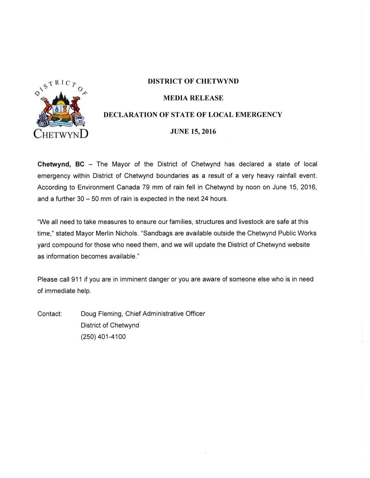
A local state of emergency is in effect in the District of Chetwynd as the region deals with major flooding.

Flood watches have been issued for several areas of northeastern B.C. and more rain is expected to fall.
The BC River Forecast Centre has issued a flood warning for Chetwynd, Tumbler Ridge, Dawson Creek and Fort St. John.
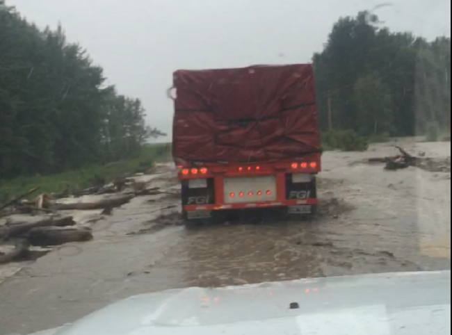
Multiple highways are already closed and thousands of BC Hydro customers are without power. The Peace Region is cut off from the rest of the province after the only highway was closed by flooding.
Chetwynd Mayor Merlin Nichols said the situation is “changing by the minute. It’s a major flood event.”
WATCH: Chetwynd declares local state of emergency:

Some parts of the region have seen nearly 100-millimetres of rain in less than 24 hours. Crews are using backhoes and excavators to keep the drainage going.
The CN Line through town has been washed out.
The River Forecast Centre says flooding is likely along the following streams Thursday:

Get daily National news
- Moberly River
- Kiskatinaw River
- Fontas River
All three rivers could reach 10-year highs.
“Water levels in smaller streams at higher elevation have risen rapidly today and are forecast to continue rising through Thursday in the Peace region with flooding in low-lying areas,” the River Forecast Centre said in a statement.
“Water levels in major streams in the region are expected to continue to rise through Friday and possibly Saturday.”
Already, there have been reports of minor flooding in Dawson Creek, Pouce Coupe and Chetwynd. Highway 97 is closed between Mackenzie and Chetwynd, and Highway 52 is closed in both directions.
“There’s an intense low-pressure centre over northern Alberta, and there’s a lot of moist air. An extreme amount of moist air feeding around that low-pressure centre, taking aim at the Peace River region,” says Global BC meteorologist Mark Madryga.
The southwestern part of Fort St. John is also without power because of a windstorm.
Nichols said CN Rail tracks in Chetwynd are out of commission and some homes outside of town are seriously damaged.
“One major stream actually changed its course and is flowing right through a private school,” he said.
The flood warnings come just a month after several fires were raging in the region, forcing evacuation orders and alerts in several areas.
“June is a month where we do get extreme variations in weather. We go from heat waves from very cool, very moist air in this month.”
Comments
Want to discuss? Please read our Commenting Policy first.