

Travelling through many parts of British Columbia can pose a serious challenge as much of the province consists of impenetrable terrain that no car, trike, trolley or snowmobile can traverse.

But now, thanks to a relationship struck between Google, Destination BC and the Northern BC Tourism Association, British Columbians and visitors alike will be able to experience some of this province’s vast wilderness online.
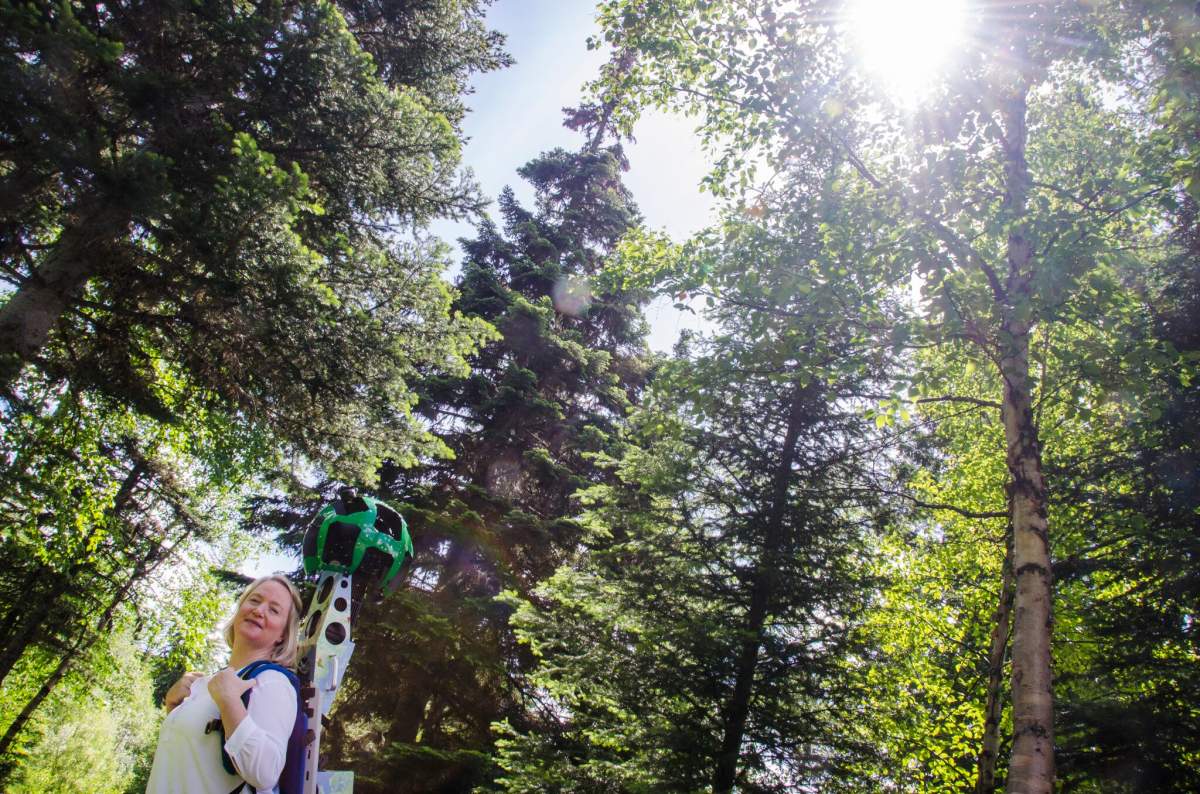
From June to September, staff teams from the tourism agencies will be outfitted with Google Street View Trekkers – wearable backpacks that contain 15 separate cameras and can collect 360-degree panoramic imagery.
They will trek more than 1,500 kilometers throughout B.C. to visually map every region of the province, including the rugged coast of Haida Gwaii, the footsteps of dinosaurs in Tumbler Ridge Global Geopark and the only known inland temperate rainforest in the world in Ancient Forest/Chun T’oh Wudujut Park, B.C.’s newly created provincial park.
Team members were trained by Google to use the specialized Street View Trekker equipment.
Trekker units are in high demand around the world and access to the technology is limited.

Get breaking National news
The wearable backpack is outfitted with a camera system on top, and its portability allows Google to gather images while maneuvering through tight, narrow spaces or locations only accessible by foot.


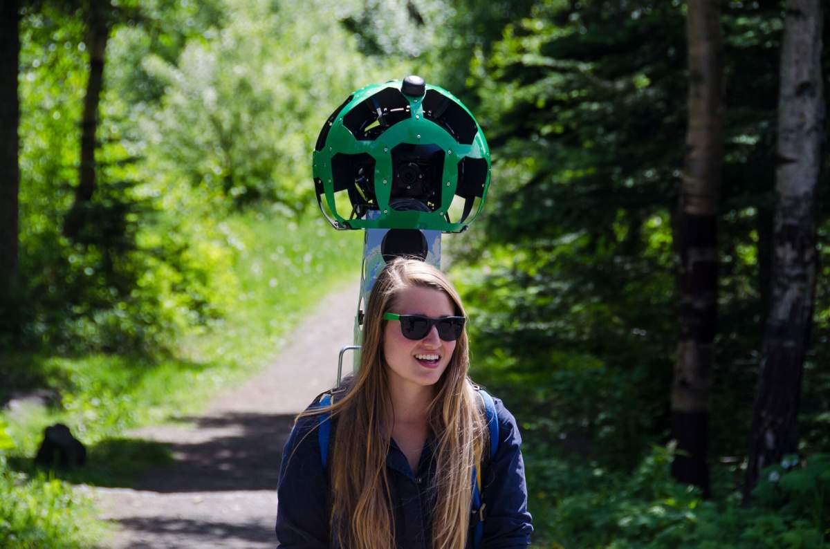


The Trekker weighs approximately 18 kilograms, and is the size of a large hiking backpack. It’s about 1.5 metres in height when set on the ground, and when worn, the camera system extends 60 centimetres above the operator’s shoulders.
“We will now be able to literally put Northern B.C.’s wild places and spaces on the map for the world to see,” said CEO of Northern BC Tourism Association Clint Fraser.
After the images are collected, they will be sent to the Google Maps team in California to be processed and uploaded to Google Maps, which takes several months.
Google Street View has already mapped a number of locations in Canada, including Banff National Park in Alberta and Cape Breton National Park in Nova Scotia.
B.C. will now join a growing list of iconic destinations around the world mapped with Google Street View Trekker, including the Pyramids of Giza, and the Grand Canyon. Trekker cameras have even been modified to capture undersea imagery in places like the Galapagos Islands and the Great Barrier Reef.
To see some of the other areas of Canada that have been mapped with Google Street View Trekker, go here.
Comments
Want to discuss? Please read our Commenting Policy first.