
Weather forecast update at 4:30pm:

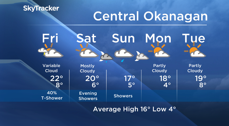
Thursday marked the beginning of the collapse of the upper ridge responsible for our sunshine and record breaking temperatures. Pacific moisture and cooler air aloft was the trigger for some afternoon thunderstorms and there is a risk of a similar situation tomorrow. Generally a shift towards cooler temperatures, with some much needed showers are in the forecast.
Friday’s daytime high range: 18C to 22C
Thank you to Llewelyn Lloyd for tonight’s Facebook photo of this morning’s Moonset.
We love sharing your photos – Please email your stories/photos to okanagan@globalnews.ca


Check out our online gallery on our webpage: http://globalnews.ca/pages/okanagan-gallery-top-viewer-photos/
We will have the rest of your weather details coming up at 5 and 6:30pm – Hope you can join us!
~ Duane English / Wesla Wong
- Canadians feel grocery inflation is getting worse despite steady cooling: poll
- Liberals apologize to Speaker for partisan post that sparked calls to resign
- Inflation continues to cool. So is the Bank of Canada ready for rate cuts?
- Quebec judge limits language law requiring English decisions be translated
Comments