
TORONTO — Hurricanes — called typhoons in other parts of the world — are the most powerful forces on Earth. Astronauts on board the International Space Station had a first-hand look at just how mind-blowing this weather phenomenon can be.

First, there’s this.
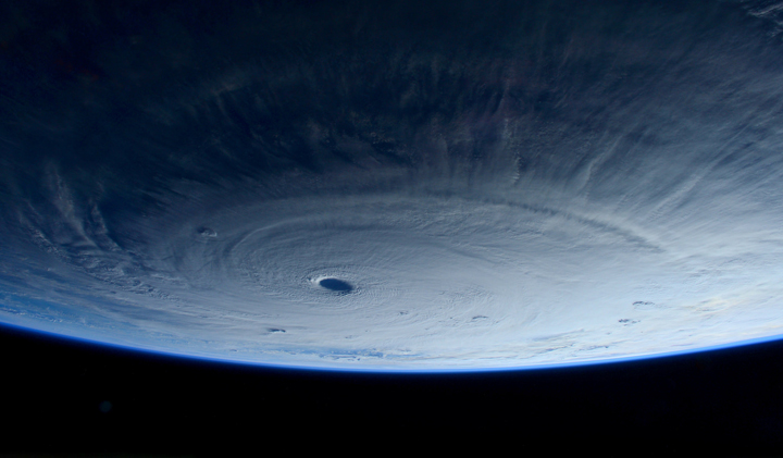
This is Super Typhoon Maysak that is churning in the North Pacific Ocean. It looks like it could swallow Earth. In reality, Maysak stretches around 1,500 km.
Want a better view?
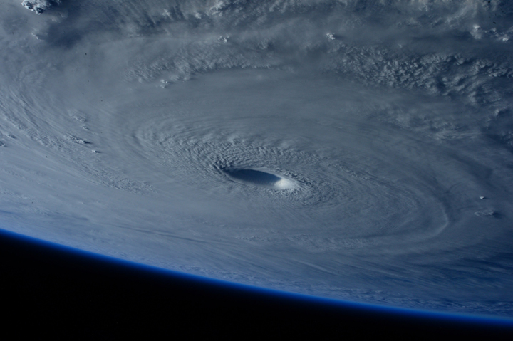
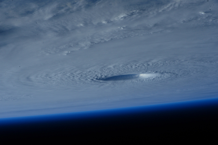
Italian astronaut Samantha Cristoforetti of the European Space Agency tweeted these photos on March 31 as the space station passed over the monster storm. The cloud tops reach about 16 km high.

Get daily National news
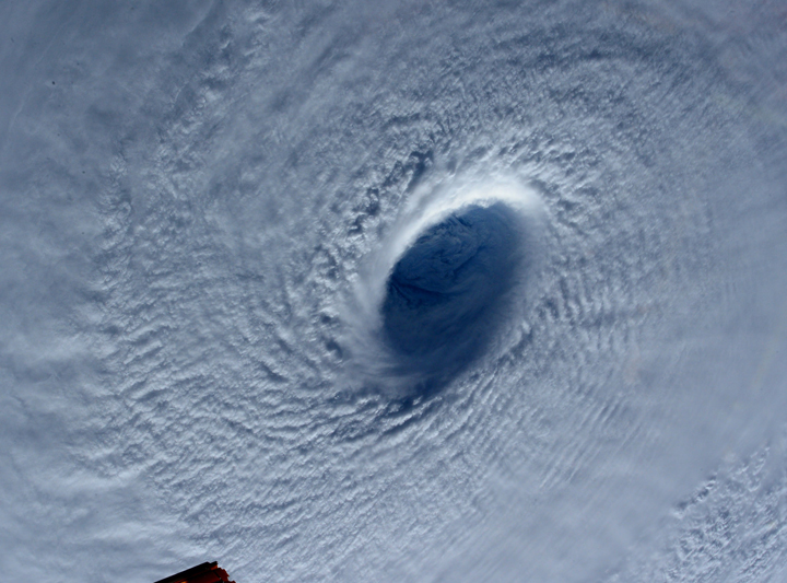
Taking us in even closer, we see the swirling clouds.
Typhoons form when warm, moist air rises. Areas with high pressure rise into an area of low pressure. That new air becomes warm and moist as well and rises. This continues as air swirls in to take its place. But as the warm air rises, it cools and forms clouds. The whole thing begins to spin and feeds off the ocean’s warmth and moisture.


And you can see it at work.
If you were to stand in the eye you’d have moderate winds and relatively clear skies. But that would be short-lived as the typhoon continued to move, and the extreme winds and heavy rains hit you with an incredible force.
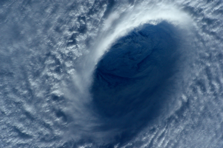
The width of Maysak’s eye is about 40 km. But looking into its eye — or perhaps more aptly, it’s heart — provides an incredible view of an awesome force of nature.
Maysak is continuing toward the Philippines but is expected to weaken before reaching the islands on Sunday.


Comments