
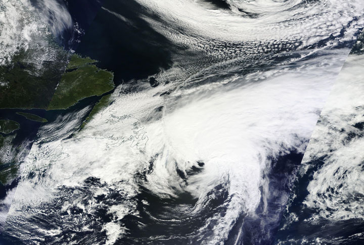
TORONTO – Though Hurricane Cristobal passed west of Newfoundland Thursday night and into early Friday, its effects were felt across the island.

The inclement weather wasn’t solely due to Cristobal, but rather the way the hurricane – downgraded to a post-tropical storm Friday afternoon – interacted with a cold frontal trough parked over the region.
Environment Canada said the heaviest rain fell Thursday night over eastern parts of Newfoundland and continued over the Avalon Peninsula on Friday.
READ MORE: Canada’s most destructive hurricanes

Get daily National news
In St. John’s, 26.2 mm of rain was reported at the airport. There were reports of anywhere from 19 to almost 35 mm in other communities, with gusts of up to 90 km/h.
Not only did the merging of the two systems bring rain and wind, but temperatures dipped down to 10 C in some parts making it feel more like fall than summer.
As the storm continued to move northeast, the Canadian Hurricane Centre warned those along the shoreline of southern Grand Banks to watch for rapid tide-like changes in harbours.
“Tropical storms that have raced across the Grand Banks (moving over 100 km/h) in the past have caused water levels in harbours to rise and fall 2 or 3 times over the span of an hour and fluctuate by as much as 2 or 3 metres,” the agency said in its final statement on Cristobal Friday afternoon.
Strong winds are expected to persist over Newfoundland Friday afternoon with gusts of up to 60 km/h.
To get real-time weather for your area, download the Global News Skytracker weather app.


Comments
Want to discuss? Please read our Commenting Policy first.