
Weather update: Thursday August 21st 4pm

The 4pm radar (see image below) shows isolated showers and thundershowers making its way across our region.
The lightening detector is also currently picking up multiple flashes in the area.


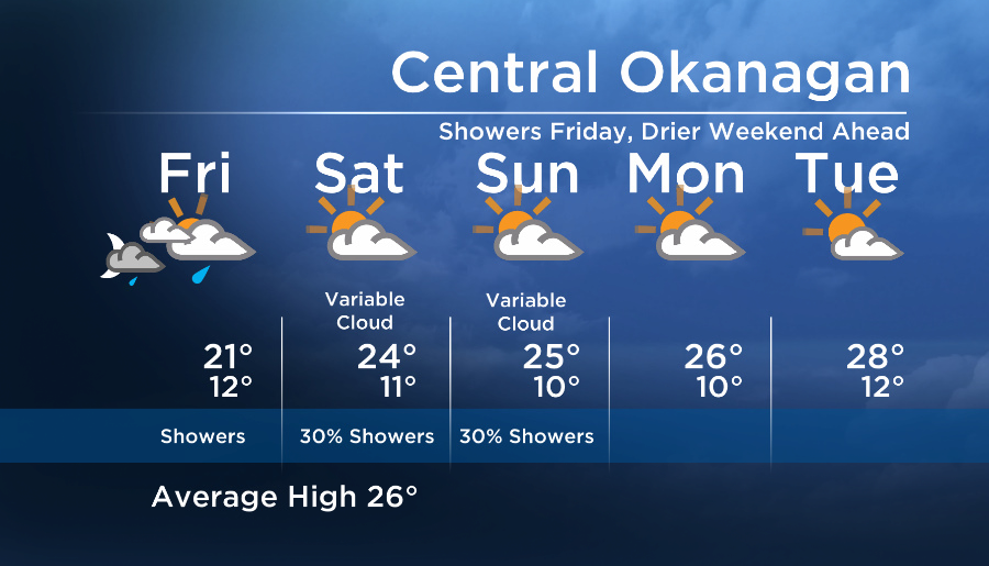
As a low develops to the south of us Friday, its circulation will direct clouds and showers into our region.
However by the weekend the low will weaken, helping to reduce the shower potential and a drier pattern will be in place.
The email you need for the day's
top news stories from Canada and around the world.
See you tonight at 5, 6:30 and 11pm!
Friday’s High: 16 to 22C
~Wesla/Duane
Comments