
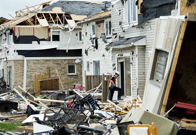
TORONTO – “The storm came out of nowhere.”

After a serious storm, be it a severe thunderstorm with hail or strong winds or a tornado, we often hear similar exclamations.
But is that a reality?
READ MORE: By the numbers – Ontario’s deadliest tornadoes
Environment Canada is responsible for issuing warnings and watches for all types of weather events. They use a network of radar, satellite and forecast models to better predict what weather we can expect. But it’s not an exact science. Spotting a tornado is easier from the ground than it is from satellites.
A tornado watch means there’s a good possibility a tornado will occur. Radar can provide some indication – such as a comma-like appearance indicating rotation of a storm – that a tornado is occurring at the time, but there is no way weather agencies can say a tornado will definitely occur somewhere.
For eyes on the ground, Environment Canada also relies on CANWARN storm spotters who will report severe activity to them.

Get breaking National news
A watch – whether it be a severe thunderstorm, tornado or snowfall event – is issued when conditions are favourable for severe weather. A warning is when hazardous weather is imminent or occurring.
Here’s a post-mortem of how Environment Canada handled Tuesday’s storms (the Angus tornado is believed to have struck around 5:20 p.m):
8:47 a.m.: First severe thunderstorm watches go out for the Bruce Peninsula, Tobermory, Southern Bruce County and area.
10:54 a.m.: Severe thunderstorm watch issued for southern Ontario, stretching from Windsor to Midland to Lindsay to Durham Region
2:25 p.m. : Severe thunderstorm watch issued for Bracebridge, Haliburton and Port Carling area.
2:37 p.m. : Severe thunderstorm watch changed to tornado watch for Angus, west to Guelph and east to Lindsay, as well as northern York Region.

3:03 p.m. to 4:54 p.m.: Tornado warning replaces severe thunderstorm warning for Midland, Barrie, Orillia, Bracebridge, Collingwood, Owen Sound and immediate areas.
5:20 p.m. Tornado warning issued for Angus, Innisfil, Orangeville, Grand Valley, Newmarket, Uxbridge and immediate areas.
While it may seem like the tornado warning was issued too late – as the tornado was occurring – Environment Canada issues a tornado warning only if there is strong evidence of rotation (as it is “imminent”). That is why weather agencies such as Environment Canada and the U.S. National Weather Service issue watches – in order to prepare residents of a particular area for the possibility of potentially dangerous weather.
Environment Canada issues these alerts on its website, which is in turn shared by media outlets. People with Weatheradios – a radio that receives transmissions from Environment Canada – also receive watches and warnings.
So a tornado watch for Angus was issued three hours ahead of the tornado. Environment Canada did its best to prepare residents who should have been aware of the possibility of a tornado in their area. It can only be hoped that it was their watches and warnings that resulted in no casualties.
To get real-time weather for your area, download the Global News Skytracker weather app.


Comments
Want to discuss? Please read our Commenting Policy first.