

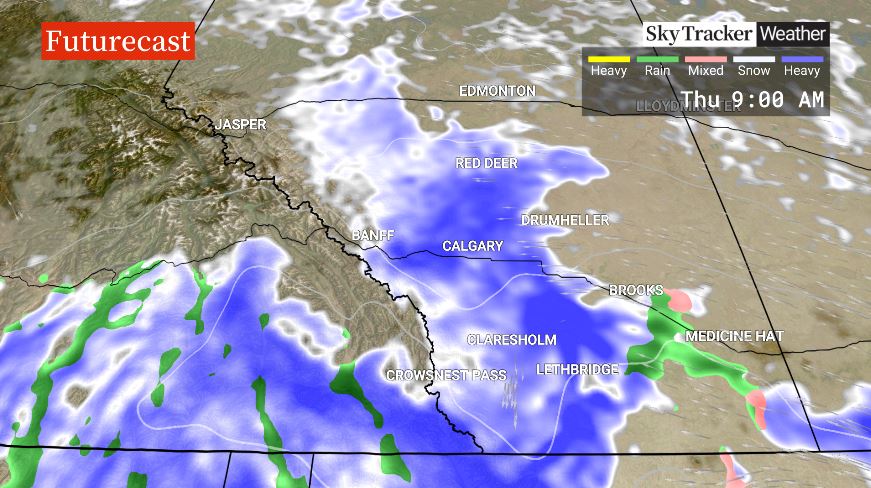
If you’re hoping to get a jump on your long weekend travel, Environment and Climate Change Canada has a warning for motorists: be prepared for some poor driving conditions as a storm system sweeps through the Calgary and Edmonton areas starting overnight Wednesday and into Thursday.

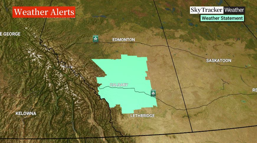
The expected messy weather has prompted Environment Canada has issued a “special weather statement” for Calgary and the surrounding area.
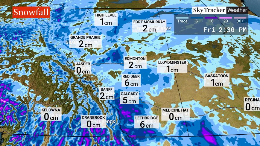
While meteorologists were initially forecasting up to 20 cm of snow to fall in the Calgary area by the time the storm moves through the region Thursday evening, the forecast was updated Wednesday afternoon, predicting only about 5 cm will fall.
“It could start as rain or rain snow mix. It continues overnight tonight and continues to tomorrow, until probably about dinnertime,” said Global Calgary traffic and weather specialist, Leslie Horton.
While temperatures are expected to hover around the freezing mark, making it difficult to predict what total snowfall accumulations will be, meteorologists warn the snow may create reduced visibility and poor driving conditions and has prompted a warning for motorists to allow extra time for travel.
Highway 2 and parts of Highway 1, in the Calgary area and west of the city, are expected to be amongst the hardest-hit areas.
The special weather statement covers an area stretching from just north of Fort Macleod in the south to Ponoka in the north, as well as Canmore in the west to Drumheller in the east.

Get daily National news
The city of Edmonton, which is not included in the special weather statement, is expected to see some flurries starting late Wednesday afternoon with up to two centimetres of snow expected before the storm moves through on Thursday evening.
“The majority of the snow is going to affect the areas from Red Deer further south, but we see a little bit still trailing up further west of Edmonton across the highway into the Whitecourt area, with some scattered flurries still closer to Peace River for that (Thursday) morning commute,” said Global Edmonton weather specialist, Phil Darlington.
“As we progress through the morning into the afternoon, we see a little bit more of a focus of snow across the north, and there’s still likely to be some in and around the Edmonton area for the afternoon into the overnight, but overnight into Friday, most of that clears out, and we’re back to a mix of sun and cloud.”
With temperatures across much of southern and central Alberta expected to hit the mid to high single digits on Friday, the snow that does fall is expected to melt quickly, creating improved driving conditions in time for the Easter long weekend.


Comments
Want to discuss? Please read our Commenting Policy first.