
TORONTO – With temperatures well below the seasonal normal for this time of year, you may be relieved to hear that warmer weather is on its way.

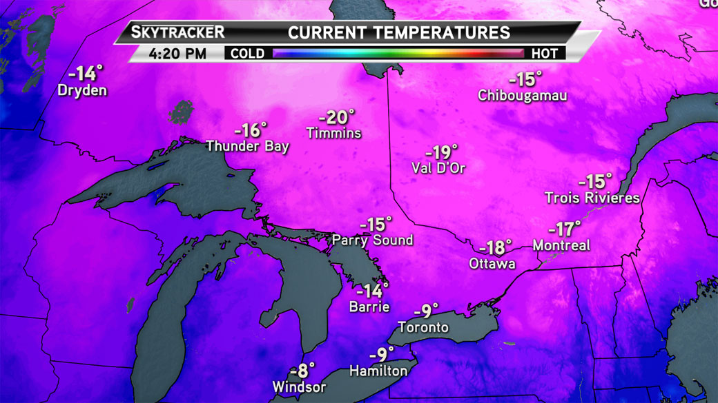
On Sunday, overnight temperatures around the GTA dropped down to a chilly -17 C as cold Arctic air settled into the area. High winds gave wind chill values of -23 C.
Toronto reached a high of just -9 C on Monday; the daytime high this time of year is 1 C.
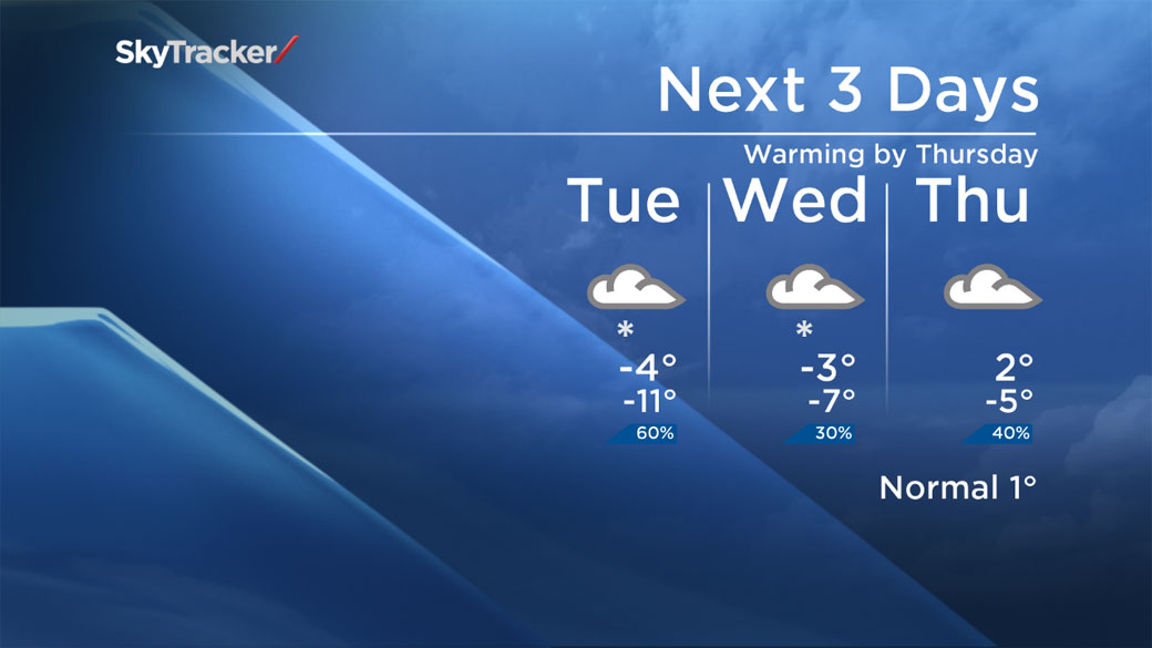
Monday’s overnight temperature is expected to be near -14 C, but by Tuesday, the mercury will climb to a more tolerable -4 C.
The City of Toronto issued an extreme cold weather alert for Monday, adding 26 extra spaces to each of their existing shelters.
Thankfully, by Thursday the temperature will finally climb to above 0 C, with a forecast high of 3 C and 6 C on Friday. However, it will be a damp Friday, as rain is expected to move into the area.
The chilly temperatures will return by next week, however, not the deep freeze we’ve seen this week.
For more info on Toronto weather, visit our Skytracker page.
Comments