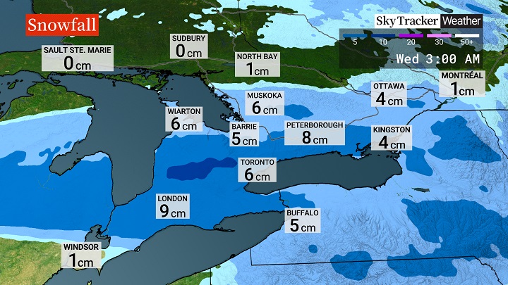
A round of snow is headed to southern Ontario on Tuesday, though a “significant” melt is on the way later this week.

Snow is expected to start very early in the morning across southwestern Ontario, with the possibility of ice pellets or freezing rain before the sun comes up, Global News meteorologist Anthony Farnell said.
By mid-morning, the snow will move into the Greater Toronto Area, with amounts of two to six cm falling by the evening, Farnell said.
He said heavier totals of up to 10 cm are likely where it’s cooler, including in north and west parts of the GTA and in ski country.
“With temperatures hovering just above freezing in downtown Toronto and right near Lake Ontario, it’s a situation where only a couple centimetres of slushy snow will add up during the day in these locations,” Farnell said.
“Rain could also mix in towards evening as the temperature rises another degree.”

Get daily National news
As of Tuesday morning, a large portion of southern Ontario, stretching from Durham Region, south past the London area, was under a winter weather travel advisory.
Extreme southwestern Ontario was under a freezing rain warning.
Late Wednesday into Thursday, a round of mostly rain will impact the region, Farnell said.
“Temperatures will continue to climb through the period, reaching six to eight degrees by the end of the week,” he said.
It will lead to a “significant snow melt,” particularly in regions that have been hard-hit by snow squalls over the past week, Farnell said.


Comments