
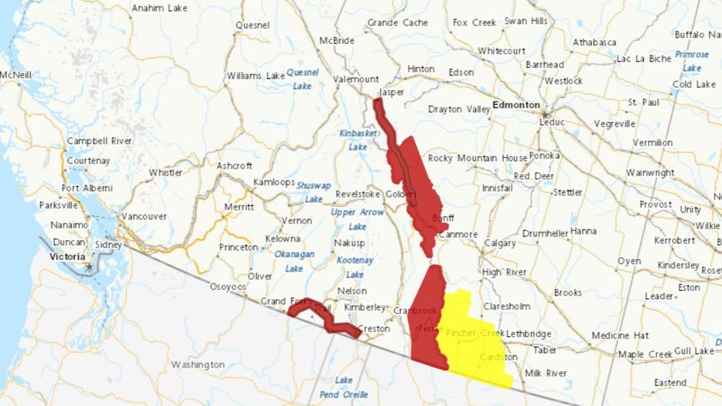
Weather warnings are still in effect for highway passes in B.C.’s mountainous southeastern regions.

Since Monday, a soggy system from the Pacific has been slowly tracking eastward, dumping copious amounts of rain.
On Wednesday, Environment Canada said rain will again continue in the Kootenays while a cold front also continues to move eastward across the province and into Alberta.

“In its wake, rain will change to snow tonight over Highway 3 and Thursday morning across Elk Valley,” said the national weather agency. “Please be advised that snowfall warnings may possibly be issued.”
For Highway 3, the forecast is calling for 20-40 mm of rain from Grand Forks to Creston (Paulson Summit to Kootenay Pass).


Get daily National news
The Elk Valley, which includes Fernie and parts of Highway 3, will also see 20-40 mm of rain.
Just north of the Kootenays, snowfall warnings are in effect for parts of the Rocky Mountains on both sides of the B.C. and Alberta border.
For the Banff National Park area, up to 15 cm of snow is expected, with the heaviest amounts expected overnight before tapering on Thursday.
And along the southwest corner of Alberta, a winter storm watch is in effect, with snowfall possibly reaching 30 cm in higher terrain.
- Tumbler Ridge students won’t ‘return to current school site’ after mass shooting
- There are changes coming to Tim Hortons menus and stores soon
- What is B.C.’s Mental Health Act and why is it relevant to Tumbler Ridge shooting?
- Inuit look to Greenland’s social model as Canada pursues military buildup in Arctic


Comments
Want to discuss? Please read our Commenting Policy first.