

You may hear meteorologists toss around words like “supercell,” “downbursts,” “microburst,” or “derecho.” That’s a lot of weather terminology, which can be confusing. Here’s a primer on a few storm words.

Supercells
Let’s start off with the king of all thunderstorms.
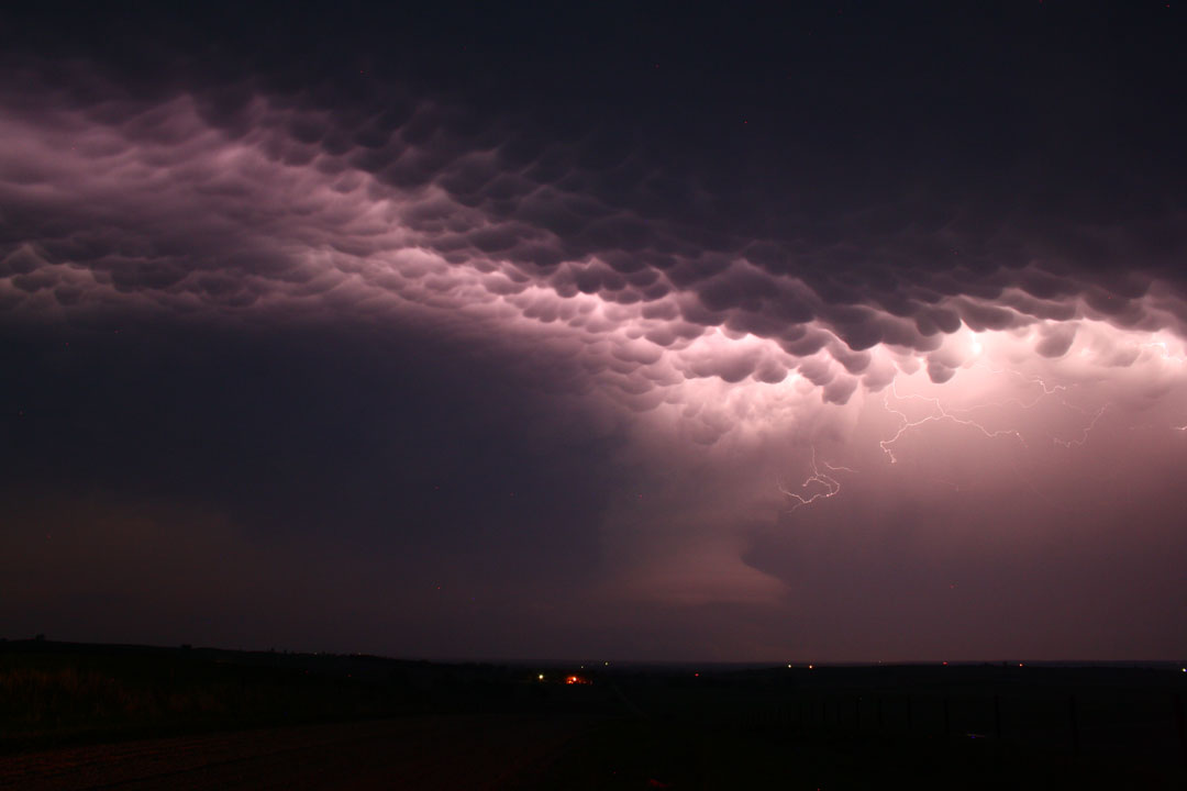
Thunderstorms form when moist, warm air rises. The air expands and cools, forming a cloud. Atmospheric instability, such as strong wind shear (the change in wind speed and direction) is essential in the formation of thunderstorms.
A supercell is a large, single-cell, severe storm. Supercells are capable of producing tornadoes, hail and damaging winds.
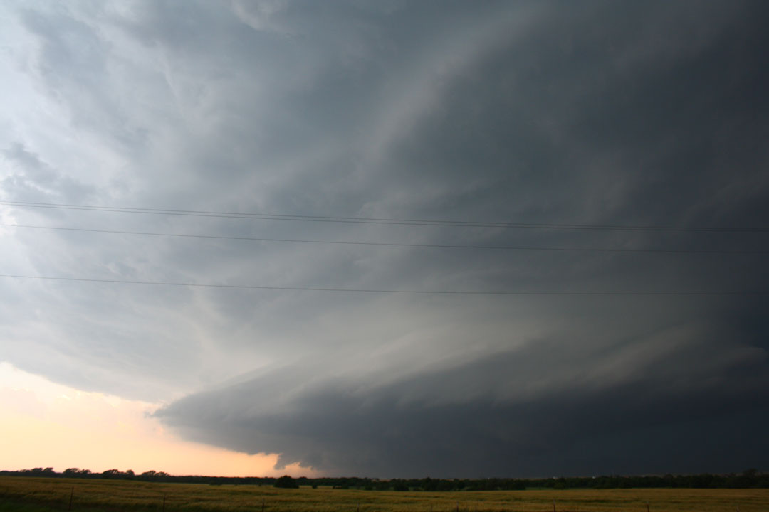
This type of thunderstorm possesses a strong, rotating updraft, or air that is moving up within the developing system. The updraft, called a mesocyclone, can reach speeds of over 160 km/h. The rotation of a supercell can often be spotted from the ground.
These large storms are responsible for the tornado outbreaks we see in the United States and the large, devastating tornadoes.
Multi-cells

Get daily National news
These types of storms form in clusters, with some cells joining together. Though each is a single cell, as the first cell matures, it is carried downstream by upper-level winds and a new cell forms upwind, thus taking its place. These storms can be non-severe or severe.
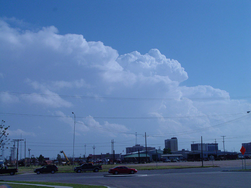
Single cell
A single cell thunderstorm is often called a pulse thunderstorm. As all thunderstorms do, a single cell forms from a towering cumulus cloud (those puffy cotton-like clouds often spotted on a summer day). There is also updraft within the storm, but essentially, the rain kills the updraft. The moisture is then cut off from the storm ending any further development of the storm.
Squall Line
A squall line is a line of thunderstorms that extend for hundreds of kilometres. Although tornadoes can develop from these types of storms, they usually produce straight-line winds.
Derechoes
A derecho (pronounced “dey-REY-cho”) is a wind storm that is associated with rapidly-moving thunderstorms. These long-lived and widespread storms are kilometres wide and hundreds of kilometres long. If you’re looking at radar, a derecho would be easy to spot: it’s a kilometres-long band of rain or a cluster of thunderstorms that looks like a bow. In fact, the radar signature is called a bow-echo. A derecho can be part of a single bow echo or multiple bow echoes.
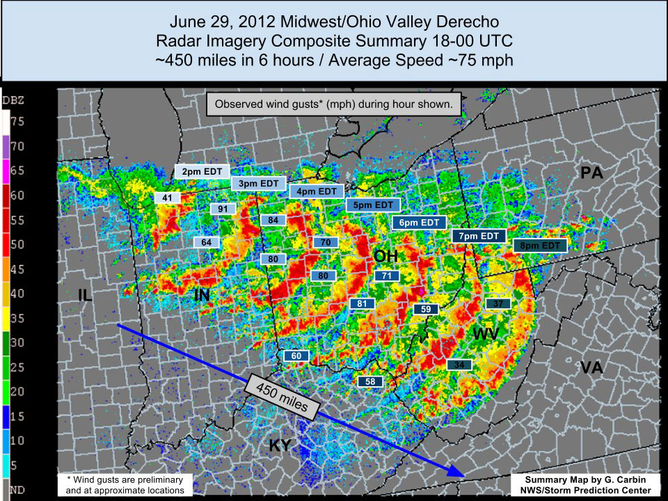
Derechoes can produce straight-line wind damage, which is exactly what it means: wind damage that comes in a straight line. Oftentimes, people mistake straight-line wind damage as being caused by a tornado.
Derechoes are most common in the late spring and summer.
Downbursts
A downburst is a strong downdraft of cold air that causes damaging winds near the surface of a storm.
Microbursts
A microburst is basically a downburst, but describes the size of the downburst.
To get real-time weather for your area, download the Skytracker weather app.


Comments
Want to discuss? Please read our Commenting Policy first.