
Tuesday, May 23, 2017 – Weather forecast update at 5am:

Enjoy sun to start today, however a change is on deck by this afternoon with increasing cloud and breezy conditions.
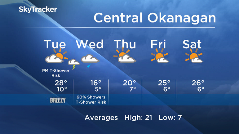
A cold front will sweep across Southern BC and bring the chance of showers and thundershowers starting this evening and tomorrow. All areas will see this threat of active weather, however the northern and central valley regions will see a moderate to high chance of precipitation, while the southern regions will only see a low to moderate risk.
We will see clearing on Thursday in the wake of the front. As another upper ridge builds in for the weekend, expect summer conditions to return by the end of the work week.


Watch out for high water levels.
Today’s daytime high range: 23 to 31C
We will have the rest of your weather details coming up at 5 and 6:30 and 11pm – Hope you can join us!
~ Duane/Wesla
- Suspect in killing of temple leader Hardeep Singh Nijjar got student visa in ‘days’
- Panera to remove ‘Charged Sips’ drink from Canada amid wrongful death lawsuits
- ‘Summer of discontent’ coming over public service in-office order: unions
- AstraZeneca says it’s withdrawing COVID vaccine amid low demand
Comments