

Not a groundhog but a Rex Block will keep Saskatoon cool with snow and extreme cold ahead.

Saskatoon Forecast
Today
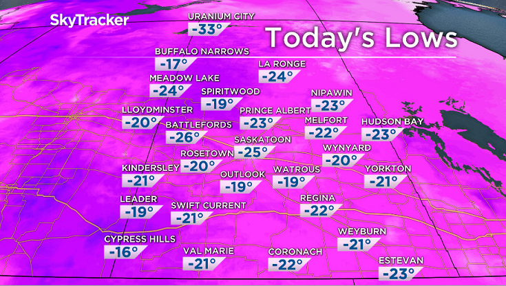
Under the influence of high pressure and clear skies, Saskatoon cooled right off last night, down to -25 with wind chills making it feel like -34 this morning.
Clouds had built back in by mid-morning with light snow moving in just before noon, which helped warm us up quickly to the mid-minus teens by midday.
Cloud cover will continue this afternoon with light snow continuing at times as temperatures continue to rise back up to around -11 for a daytime high.
Tonight
Clouds will clear back out this evening and clear skies overnight will allow us to fall back into the -20s.
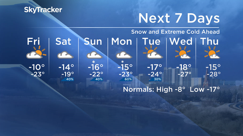
Friday
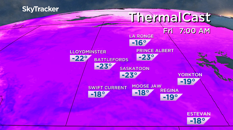
-30 is around what it’ll feel like with wind chill when you head out the door on Friday as clouds build back in during the morning, but some sunny breaks likely to start the day.
Temperatures should rise into the mid-minus teens by noon before topping out around -11 in the afternoon under predominantly mostly cloudy skies.
Weekend
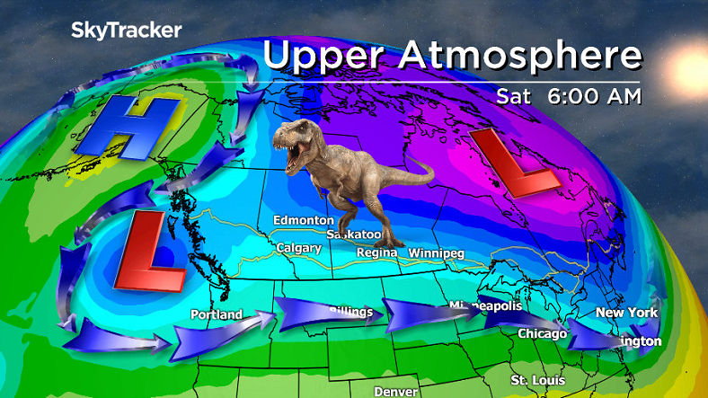
A Rex Block holding pattern, which is a strong high pressure system typically north of a strong low pressure system that inhibits east-west movement in the atmosphere, will keep temperatures rather stagnant over the region into next week.
A system sliding by south of the city on Saturday will keep us in the clouds with a good chance of light snow on Saturday with lingering clouds with a chance of flurries sticking around for Sunday.
Daytime highs will sit in the mid-minus teens with lows close to or into the -20s both days.


Work Week Outlook
The next system will swing by on Monday, bringing in a good chance of snow that may accumulate to a few centimetres worth before clouds clear out late Tuesday and mostly sunny skies move in mid-week.
Daytime highs will start the week in the mid-minus teens before falling back to around -18 by Wednesday as another arctic high drops in, pushing morning lows as low as -28 with -40 wind chills likely.
This Your Saskatchewan photo of llamas was taken by Darcy Conn in Viceroy:

Saskatoon weather outlook is your source for Saskatoon’s most accurate forecast and is your one stop shop for all things weather for central and northern Saskatchewan with comprehensive, in depth analysis that you can only find here.
Comments