
Wednesday, January 18, 2017 – Weather forecast update at 5am:

The next couple of days will stay unsettled with waves of precipitation moving inland from the southwest.
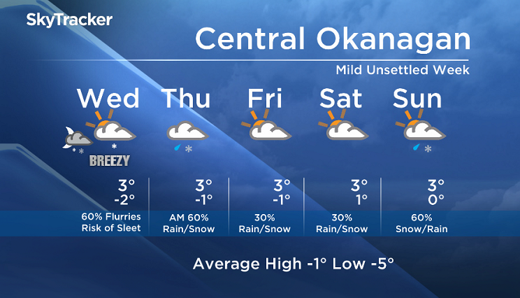
Flurries are likely on to linger this morning, however a thin layer of above freezing temperatures at 2000m will bring the risk of sleet for some areas.
As milder air continues to fill the valley bottoms, we will see precipitation change to rain for the majority of the populated areas by Thursday. Higher elevations will continue to see snow.
The complex weather pattern over the next few days is adding to the level of uncertainty. Under a southwesterly flow aloft, we will likely see one low after another move into BC, however the exact track of these lows are unknown. At this time, we are anticipating a drier trend on Friday and Saturday.


Today’s daytime high range: -1 to +5
We will have the rest of your weather details coming up at 5 and 6:30 and 11pm – Hope you can join us!
~ Duane/Wesla
Comments