
Wednesday, April 27, 2016 – Weather forecast update at 4pm:

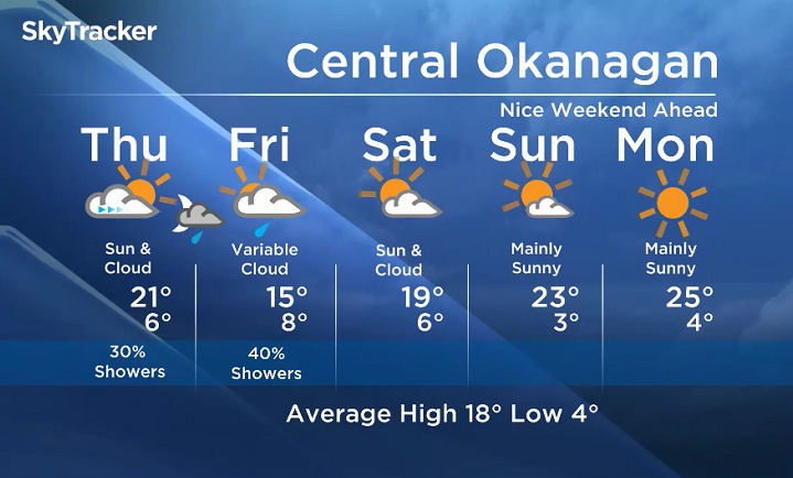
A mix of sun and cloud to start on Thursday, but daytime heating will be responsible for increasing cloud and a slight chance of afternoon showers. Although many valley areas will stay dry, we will see the highest probability of showers near mountains. There will also be a slight risk of a thundershower.
On Friday, a frontal system pushing inland will bring more cloud and a higher probability of showers to the valley areas.
An upper ridge strengthening over the area starting Saturday will bring the return of warmth and sun this weekend.


Thursday’s daytime high range: 15C to 19C
We will have the rest of your weather details coming up at 5 and 6:30 and 11pm – Hope you can join us!
~ Duane/Wesla
- Toronto Pearson gold heist: Ontario man arrested at airport after arriving from India
- Capital gains changes could have ‘irreversible’ effects, business groups warn
- Renters so far more ‘vulnerable’ than homeowners amid higher interest rates. Why?
- After tornado outbreaks in the U.S., could Canada see similar storms?
Comments