
WINNIPEG – Instability in the atmosphere lead to a narrow line of severe thunderstorms from McGregor to Holland Manitoba. Approximately 50mm of rain fell in those areas but even more is possible late Friday afternoon and overnight in the Red River Valley.

Humidex values will once again be very high. Though Heat Warnings have been turned off, humidex values in Winnipeg will likely reach 38-40 when temperatures peak Friday afternoon.
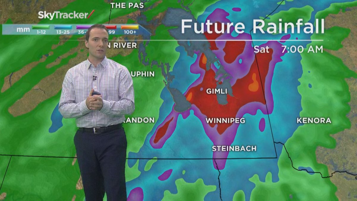
Late this afternoon, close to dinner time, is when the storm is expected to reach the city. According to Environment Canada, there is potential for golf ball sized hail at the front end of the storm. Afterwards, heavy downpours into the night.


Thursday, forecasters were calling for rainfall rates of 25-50mm/hr.
The storm will last through the light and indications are rainfall amounts throughout southeastern Manitoba will be between 20-30mm.
However, as the thunderstorms develop amounts could be much higher. Some models are predicting local amounts of 50-70mm.
The rest of the weekend is expected to be cooler with less humidity. More rain is likely Saturday night and Sunday but it will not be nearly as significant as the storm Friday night.
- Trudeau tight-lipped on potential U.S. TikTok ban as key bill passes
- Canadian man dies during Texas Ironman event. His widow wants answers as to why
- Hundreds mourn 16-year-old Halifax homicide victim: ‘The youth are feeling it’
- On the ‘frontline’: Toronto-area residents hiring security firms to fight auto theft
Comments