
Weather Update: Tuesday July 22nd 4pm

A southerly flow is in place tonight ahead of a system that will be crossing our region over the next couple of days.
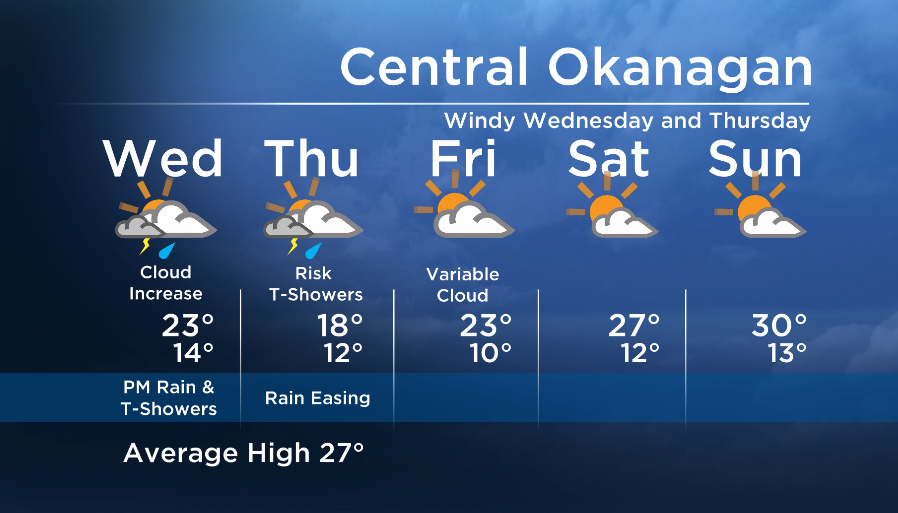
This flow has been bringing in more could and a few showers, especially for areas near the mountains.

Tomorrow, we will once again see partly cloudy conditions to start, then increasing cloud and afternoon showers with the risk of thundershowers as an upper low moves into our region.


This will also keep our temperatures cool on Wednesday and Thursday.
The slow moving nature of this system will keep showers in the forecast on Thursday morning, but the precip will ease in the afternoon/evening.
Friday and the weekend looks a lot drier and warmer for the Southern Interior.
Wednesday’s High: 19 to 25C
~Wesla/Duane
Comments