
Weather update Tuesday 4:30pm

A drier start led to a more active afternoon as a cold front pushed across our region.
We are starting to see clearing in parts of the valley now that some regions are in the wake of the cold front.
The email you need for the day's
top news stories from Canada and around the world.
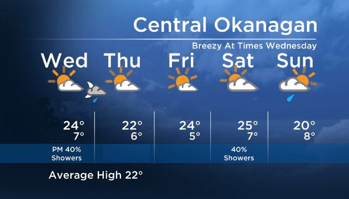
On Wednesday, an upper trough will swing across Central BC, so although it will skim across parts of the Central and Southern Okanagan Valley regions, most areas south of Kelowna will just see a 40% chance of a shower.
However, the North Okanagan, Shuswap and Columbia regions will see more cloud, a bigger chance of showers with the risk of an afternoon thundershower.


A more stable weather pattern will be in store for all of the BC South-Central Interior for Thursday and Friday.
Wednesday’s High: 20 to 25C
~Wesla/Duane
Comments