
ABOVE: Residents along Australia’s far northern Queensland state towns continued to brace for one of the most powerful cyclones to hit the area on Friday

TORONTO – An intense tropical cyclone is set to make landfall in Queensland, Australia, on Friday, and the country’s weather service is warning residents to move to higher ground.
Tropical Cyclone Ita intensified on Thursday as it made its way from Papua New Guinea toward Queensland. A large and well-defined eye developed and, as of Thursday night local time, Ita’s maximum sustained winds were estimated to be 215 km/h. Satellite data revealed that rainfall was falling at 99 mm per hour.
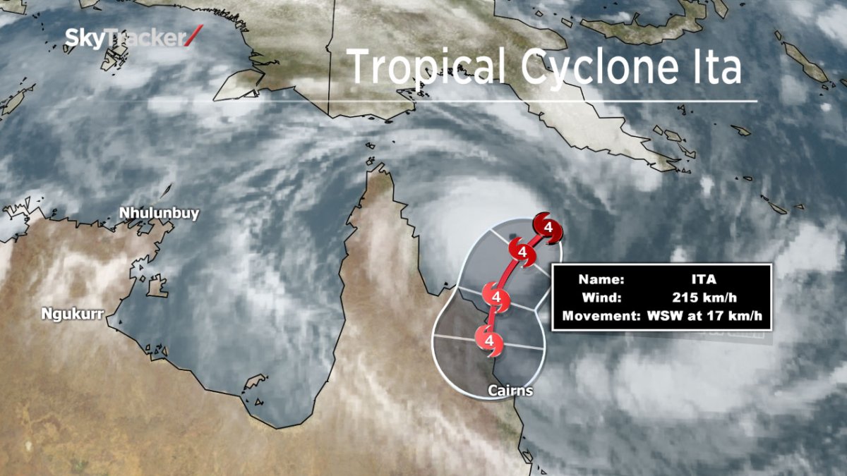
The cyclone is expected to make landfall between Cape Melville and Cape Tribulation on Friday as a “severe Category 5 tropical cyclone with very destructive winds,” according to the Australian Bureau of Meteorology. A Category 5 on the Australian scale is a Category 4-5 on the Saffir-Simpson Scale used in the United States and Canada. A Category 4 produces winds between 209 to 251 km/h; a Category 5 produces winds higher than 252 km/h.
Due to Ita’s intensity and heavy rainfall, damaging winds, high tides and flash flooding are all a danger to those in low-lying areas. The weather service has advised residents to seek shelter and move to higher ground.
Comments