
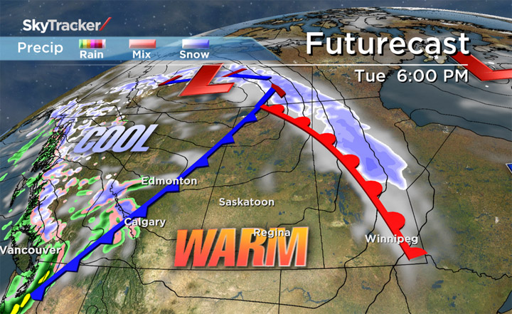
SASKATOON – Temperatures will skyrocket into the upper teens and even low 20s across parts of Saskatchewan on Tuesday.

The major warm up is thanks to the jetstream pumping in an upper-level ridge of high pressure over the Prairies.
A low pressure system developing in Northwest Territories will swing Saskatchewan into the warm sector of the system for just over a day.
Tuesday will be the warmest day so far for 2014.
However, by Wednesday morning a cold front will move through bringing a slight chance of precipitation and relatively cooler, more seasonal temperatures for the rest of the week.
The month of March saw temperatures an average of 4.3 degrees cooler than normal and near-normal snowfall in Saskatoon.
While April kicked off on the cool side, a rebound above seasonal should be seen across much of Saskatchewan.
On April 8 2013, 33 centimetres of snow sat on the ground in Saskatoon with a morning low of minus 21 and a high of minus six.
Regina had 35 cm on that day and only climbed to minus nine.
Both Saskatoon and Regina currently have only trace amounts of snow left to report with expected daytime highs over 20 degrees warmer than last year expected on Tuesday.
When snow sticks around in spring like last year, temperatures stay cooler longer as the snow’s high reflectivity value reflects energy from the sun much more than grass or soil.
While snow may still be seen during April, with warm days ahead, whatever white stuff does fall will have an increasingly harder time sticking around.
Want your weather on the go? Download Global News’ Skytracker weather apps for iPhone, iPad and Android.
Comments