
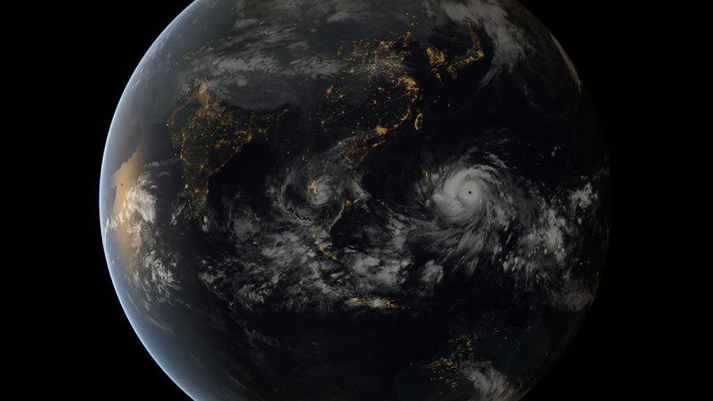
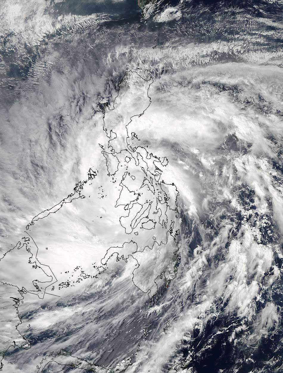
TORONTO – It will likely take some time before the complete devastation of Super Typhoon Haiyan is fully understood, but even in the immediate hours after the massive storm hit the Philippines, it’s clear that it will be substantial.

READ MORE: Gallery: Thousands flee before typhoon hits Philippines
Just before making landfall, the Joint Typhoon Warning Center (JWTC) clocked the winds of Haiyan (called Yolanda in the Philippines) at 314 km/h with gusts up to 379 km/h.
The Philippine Atmospheric, Geophysical and Astronomical Services Administration (PAGASA) recorded winds of 234 km/h when the storm made landfall at 5:10 UTC. Waves battered the shores, winds bent trees, ripped roofs off of buildings and rainfall caused flooding and mudslides.
Making a super typhoon
The making of a hurricane or a typhoon (which are one in the same), requires specific ingredients.

Get daily National news
Jump down to read more about the difference between hurricanes and typhoons
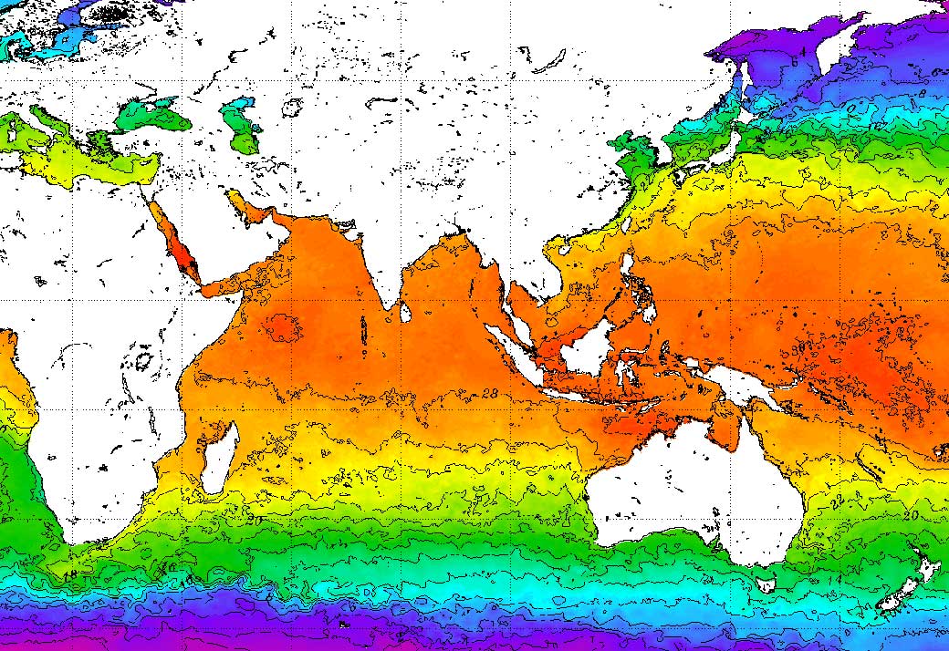
An area of convective disturbance, like a thunderstorm, is needed. Ocean temperatures of at least 26 C at a depth of 45 metres also helps to fuel a tropical storm.
The final ingredient is low wind shear. This means that winds do not change much in direction or speed.
If there is a disturbance over warm ocean waters, heat and energy gathers. The winds spiral up into the disturbance’s area of low pressure (low pressure systems bring unsettled weather like thunderstorms). The warm water adds moistures and heat which helps the air rise. The lower the air pressure, the stronger the storm will be.
The moisture condenses into droplets and more heat is released giving it more energy. Then, if there is low wind shear, the storm can continue on as well as strengthen.
The eye of a hurricane is where the winds are at the calmest. It is also where the air pressure is the lowest and the temperatures are the warmest.
In the case of Haiyan, the warm waters of the Pacific and Philippine Ocean continued to feed into the disturbance. Ocean surface temperatures in the area were near 30 C. There was also very little wind shear which allowed the storm to continue to strengthen.
Though not as powerful as the most powerful tropical cyclone (tropical cyclones and hurricanes are the same; different weather organizations have different criteria for categorizing them), Haiyan is a historic storm.
The Philippines is no stranger to typhoons. According to (PAGASA), the Philippines receives, on average, about 20 tropical cyclones a year, 10 of them typhoons.
The most powerful tropical cyclone in recorded history was Olivia, which struck Australia in 1996. The storm packed winds of a mind-boggling 407 km/h, making it the most powerful surface winds ever recorded on Earth.
Super Typhoon Nancy, which struck the Northwest Pacific in 1961, was once considered the most powerful, with winds near 343 km/h. But further research found that maximum sustained winds estimated for typhoons in the 1940s to 1960s were likely too unreliable.
The difference between hurricanes and typhoons
Typhoons and hurricanes are one in the same.
In the Atlantic and Pacific, storms are called hurricanes. In the northwestern Pacific, the storms are called typhoons.
The southeastern Indian Ocean and southwestern Pacific refer to them as severe tropical cyclones.
In the southeastern Indian Ocean and southwestern Pacific, they are always called tropical cyclones. In the northern Indian Ocean, however, they are referred to as tropical cyclones.
Maximum sustained winds of at least 119 km/h are required to be classified as a hurricane, typhoon or cyclone. Super typhoons are storms that have sustained winds of 241 km/h.


Comments
Want to discuss? Please read our Commenting Policy first.