

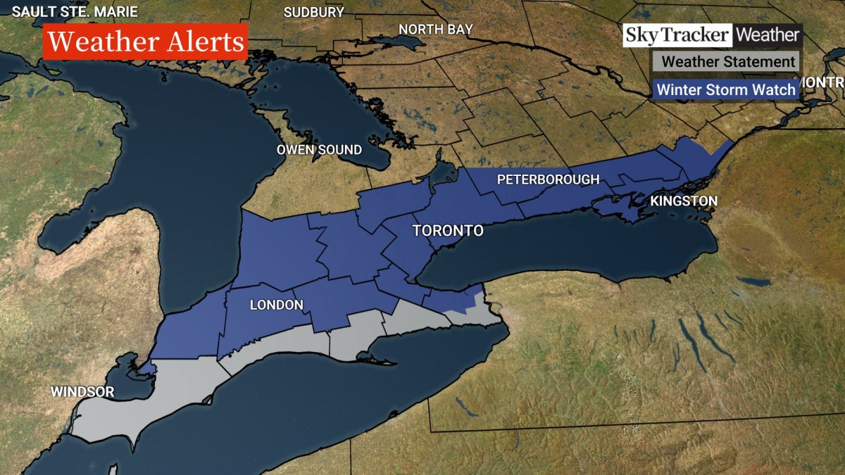
A winter storm warning has been issued by Environment Canada for London, Ont., and Middlesex County as the region braces for an incoming bout of heavy snow, set to start Friday.

According to the advisory, a low-pressure system making its way from Texas will arrive in the region Friday and is expected to bring heavy snow and strong winds across southern Ontario.
“Right now, what we see is that it will arrive around four in the afternoon, so you may be able to squeak out the morning commute, but your afternoon commute will not be so good at all,” said Gerald Cheng, a meterologist with Environment Canada.
“Towards the evening hours, that’s when the snow will get very heavy. Right now, we’re expecting anywhere from 10 to 20 centimetres of snow, and the snow will continue through Friday evening into the overnight hours, but it will all end when you wake up on Saturday.”
Wind gusts up to 60 km/h will cause blowing snow, resulting in significantly reduced visibility on area roads, according to the advisory.
The city of London says roads crews preemptively applied sand and salt to roads and sidewalks and will continue to do so when the snowfall begins.
Overnight on-street parking is suspended to give plows the room they need to maneuver.

Similar winter storm warnings are in place as far west as Sarnia-Lambton and as far east as Brockville and Kingston.
Huron County was also under a winter storm watch as of late Thursday afternoon, while Perth and Oxford counties were upgraded to a winter storm warning.
Elgin and Norfolk counties were under special weather statements late Thursday that called for total accumulations of 10 to 15 centimetres.


“Temperatures in some areas across the region may remain above zero during the snowfall, which may limit accumulations slightly,” the winter storm watch reads.
“There remains some uncertainty at this point to the placement of the heaviest snow. Winter storm warnings or snowfall warnings may be issued as the event draws nearer.”
For Friday, Environment Canada’s forecast for London calls for snow, at times heavy, mixed with rain beginning in the afternoon, gusty winds and a high of 4 C, dipping to a low of -1 C overnight with the aforementioned snow.
Saturday and Sunday are both forecast to see a mix of sun and cloud, a 40 per cent chance of flurries, and highs of 2 C and 4 C, respectively.
“As we head into the next workweek, there will be several disturbances, so I can’t promise completely dry weather,” Cheng said.
According to the preliminary forecast, Monday could see a 60 per cent chance of showers in the afternoon and a 60 per cent chance of flurries in the evening.
The average high for this time of year is 1 C. The record for the greatest snowfall in London on March 3 is 14.7 centimetres in 1954, according to Environment Canada.
Comments