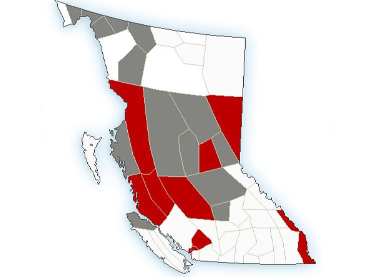
Weather warnings for cold temperatures are blanketing the middle section of B.C.

Issued by Environment Canada, extreme cold and arctic outflow warnings stretch from Whistler and North Vancouver Island to the North Coast and inland, including the Chilcotin and Peace River regions.
The warnings stem from an arctic airmass that’s currently parked over western Canada, with temperatures plunging well below seasonal averages.
“A strong ridge of high pressure over the B.C. Interior will continue to force arctic air out to the coast via valleys and inlets,” said Environment Canada.
Notably, though, there are no weather warnings for the Lower Mainland and Southern Interior, along with most of Vancouver Island.
Areas under an arctic outflow warning will see wind chill values of -20 or lower near the coast and wind chill values of -35 to -45 for inland sections.
“This cold airmass will remain in place until Friday afternoon, with the coldest wind chill values occurring during the overnight and morning hours,” said Environment Canada.

Regions under an arctic outflow warning include:
- Whistler
- Central Coast (coastal and inland sections)
- North Coast (inland sections)
- Chilcotin
- Prince George
- Peace River
- Yoho Park / Kootenay Park
- Elk Valley

Areas under extreme cold warnings will not only see colder-than-normal temperatures, but also the possibility of 10 to 30 cm of snow beginning Friday.
“A frontal system is forecast to cross the B.C. coastal mountains Friday night and move into the B.C. Interior this weekend,” said Environment Canada.
“Snow is forecast to begin Friday evening and taper off late Saturday as the system moves southward.”
Regions under an extreme cold waring include:
- North Vancouver Island
- North Coast (coastal sections)
- Cariboo
- Bulkley Valley
- Stuart / Nechako
- McGregor
- Williston
- Dease Lake
- Cassiar Mountains
- Atlin / South Klondike Highway

In related news, three B.C. communities set new records for daily low.
Bella Bella
- New record: -7.9
- Old record: -6.1, set in 2011
Malahat area
- New record: -5.8
- Old record: -5.5, set in 2022
Sparwood
- New record: -23.0
- Old record: -22.4, set in 1993


Comments